When you click on links to various merchants on this site and make a purchase, this can result in this site earning a commission. Affiliate programs and affiliations include, but are not limited to, the eBay Partner Network.
Travel America - A Red Road Journey - With Native American History
Come explore Turtle Island/North America with me!
I was born in Kespek,Mi'kma'ki.In the part known today as Aroostook County,located in northern Maine.I am a proud L'nu of the Mi'kmaq,Tribal,Sovereign Indian Nation and one of the few (less than 1,500 members) making up the Aroostook Band of Micmac.The only band in the United States.'Micmac' is a colonial mispronunciation but it's important to know for historical research.
L'nu (sounds like Ull-new) meaning the people.
Mi'kmaq (sounds like Meeg-maw) meaning my friends.
Mi'kma'ki (sounds like meeg-maw-gee) is our ancestral homelands.Today this region is also known as Northern Maine of the US,the Atlantic Provinces and Maritimes of Canada.Mi'kma'ki remains unceded and is it's own Sovereign Nation as it has been for thousands of years.Historical evidence shows,we have always been a sharing and giving people,although the same respect and gratitude has yet to be returned in kind.
Oral stories and archaeological evidence shows,that we have lived here for well over 10,000 years.
This is no new world.Nor was it just recently discovered for the first time,just 500 years ago.This is home to many great civilized nations,rich in culture,various languages and traditions.Full of large cities and trading posts.Homes still remain here from days long,long ago.Before it was known as the America's,we called it Turtle Island.Through vision,we foresaw blue eyed people on floating islands coming to our lands one day.
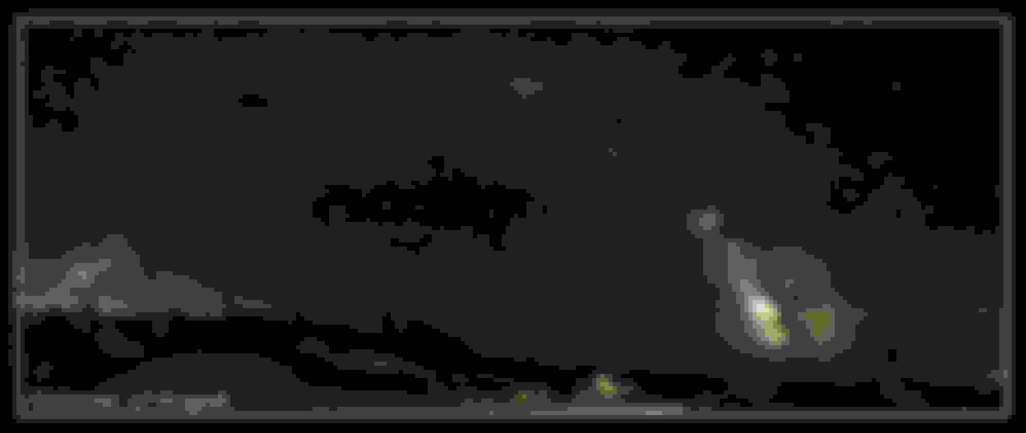
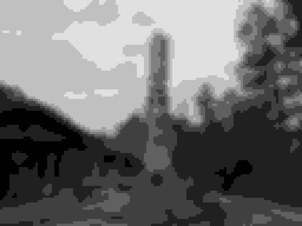
Cadillac Mountain, Acadia NP I sit below skite'kmujuawti (the spirit path) and honor my ancestors
The responsibility 'the people of the first light' have,is to hold up the sky.
Click here to listen to my peoples honor song. Mi'kmaq Honor Song
- English Lyrics -
Let us greatly respect our being L'nu
My people let us gather
Let us greatly respect our native roots
My people let us help one another
Let us help one another as Creator intended when he put us on the earth.
Way-yoh-way-hi-yah
Way-yoh-way-yoh-way-hi-yah
Way-yoh-way-hi-yah
Way-yoh-way-hi-yah
Way-yoh-way-hi-yah
Way-yoh-way-hi-yah
Way-yoh-way-hi-yah-hay-yoh
I begin with a point and shoot then eventually upgrade to a DSLR.It takes me a little while to learn some photography basics but I eventually get the hang of it.This is several road trips and includes all the lower 48 states and parts of Canada.The videos and NA imagery are random from the net and are not created by me.All the locations photos are shot by me personally.Daytime and astrophotography.
You don't need to spend big money to have big fun,nor drastically increase your carbon footprint.I travel with a 4 cylinder car and a tent and though I realize this isn't for everyone,I wouldn't do it any other way,at least not until retirement.
I'll try and find a bit of info about the first peoples and how we lived and live in each location today.This isn't because I feel my ancestors are of more importance,it's just that my people as a whole,have been pushed to the side and forgotten.A reminder and a tribute to those who used to live here for thousands of years,since time immemorial and those of us who still do,is the least I can do.
I hope my walk through life helps you to find a deeper appreciation for our great mother earth.I hope as you read from my perspective along with other first nation peoples,that you'll see we too,however also imperfect,are not the stereotypical, silly and often heinously portrayed as heartless savages,that you have purposely been mislead to believe we are,since the Europeans arrival.The truth is,we are simply often misunderstood.Rich in culture,highly value mother earth over any amount of man made riches,are caring,respectful,honorable,giving peoples,full of love and compassion for everyone.Even after five hundred plus years of displacement, genocide and hostility,it hasn't changed our core values and we still welcome and love you.
If you try to understand me using a scale of white mans political culture,by placing me either on the left or the right or somewhere else in between,then I'm afraid my brother,you'll never come to understand me,for I'll not stand on the right nor the left hand side of corruption.
I hope you pass this appreciation of mother earth and all her children, on to your children and teach them to pass it to theirs.If I succeed in doing this for just one parent of a child,I will have accomplished an achievement far grater than any amount of fame or riches.
............Like most Native American beliefs, the Mi'kmaq traditional spirituality is animistic. This does not mean that we worship animals - the term 'animism' means that we recognize and acknowledge the living spirit within all things. As one would expect, this encompasses the entire animal kingdom, but we also acknowledge the spirit within plants, and within the rocks and waters of our world. We also do not 'worship' these things. Instead, we recognize that their spirits and our own are akin to each other, and we treat these spirits with the same respect we wish for ourselves. As in many Native American traditions, this respect is expressed verbally with the phrase "All My Relations," which acknowledges our connection with all things around us. In Mi'kmawi'simk, this translates as Msit No'kmaq ("Mm-sit Noh-goh-mah") which is one of the most meaningful phrases in the language.
Native spirituality demands that we recognize our place in the world around us, and never forget that we are surrounded by other beings who are just as deserving of life as we are.
For those of you who might not know the term Walking the Red Road or its intended purpose,basically, it is living a life of truth, humbleness, respect, friendship, and spiritually. Those on this road are by no means walking a perfect path, but are in search of self-discovery and instructions. While there is much more information and teachings about a life on the Red Road, a more complete understanding would come from our Native American elders and leaders, who themselves have traveled this path for a while.
is to know you stand on equal ground
with all living things. It is to know that
because you were born human,
it gives you superiority over nothing.
It is to know that every creation carries a Spirit,
and the river knows more than you do,
the mountains know more than you do,
the stone people know more than you do,
the trees know more than you do,
the wind is wiser than you are,
and animal people carry wisdom.
You can learn from every one of them,
because they have something you don't:
They are void of evil thoughts.
They wish vengeance on no one, they seek Justice.
- by Traci, Blood Poet
(Quoted in part from spiritalk.net.)
I am of the Wabanaki; 'The People of the Dawnland' / 'The People of the First Light' / 'Easterner'
I am a warrior. Truth, love and sharing of knowledge are my only weapons and this is my journey...
Last edited by FORDF250HDXLT; 04-20-2020 at 11:45 PM.
Reason: Last updated 4/21/20
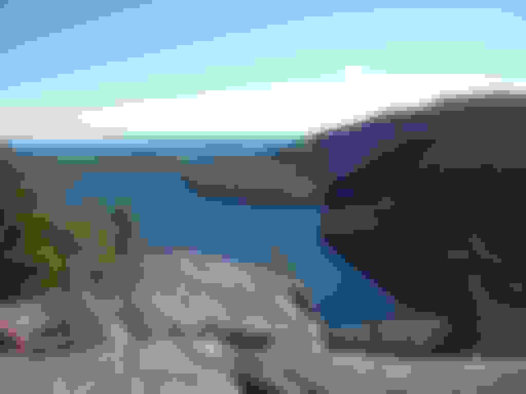
Acadia National Park,Jordan Pond, Mt Desert Island,Maine
Acadia National Park protects the natural beauty of the highest rocky headlands along the Atlantic coastline of the United States, an abundance of habitats, and a rich cultural heritage. At 3.5 million visits a year, it's one of the top 10 most-visited national parks in the United States. Visitors enjoy 27 miles of historic motor roads, 158 miles of hiking trails, and 45 miles of carriage roads.
View of Jordan pond from the bubbles trail. Jordan pond serves as the water supply for the village of Seal Harbor.
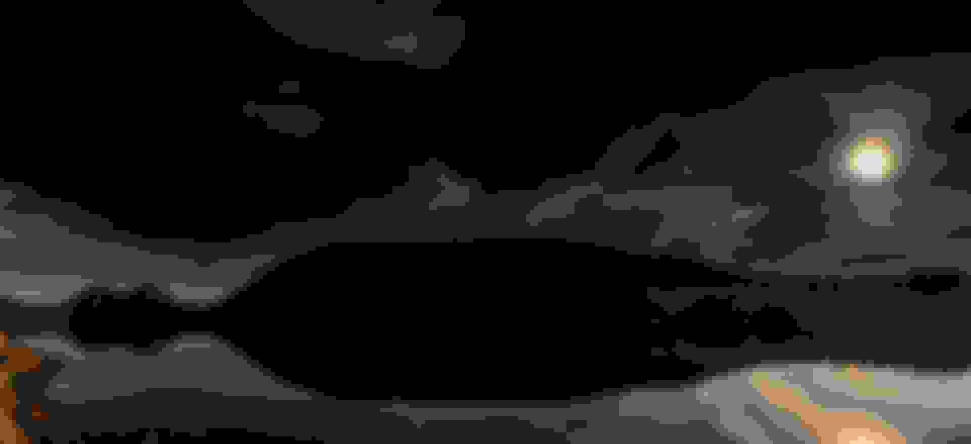
Latter,when I upgrade from a point and shoot,you'll see much improved photos such as this one that I'll add in latter posts. This is moonlit Jordan Pond taken from the trail that loops around the pond. Those small hills there to the left are the "bubbles" where I took the first photo above (with a little point and shoot camera) from, now years prior.
Native American peoples have inhabited the land we now call Maine for 12,000 years. Today four distinct tribes—the Maliseet, Micmac (correction: Mi'kmaq) , Passamaquoddy and Penobscot—are known collectively as the Wabanaki, or “People of the Dawnland.”
Mount Desert Island and Acadia National Park have remained in the center of Wabanaki traditional homelands for thousands of years. Long before Europeans arrived, the Wabanaki traveled here in seaworthy birchbark canoes. Setting up temporary camps near places like Somes Sound, they hunted, fished, gathered berries, harvested clams, and traded with other Wabanaki. Some called Mount Desert Island “Pemetic,” meaning “range of mountains.”
In the nineteenth century, Wabanaki people came to sell their handmade ash and birchbark baskets to wealthy travelers, and to harvest precious basket-making resources like sweetgrass. Summer tourists and summer residents alike were entertained by elaborate Wabanaki dance performances at venues such as Sieur de Monts and the town of Bar Harbor. Led by Wabanaki guides, canoe trips around Frenchman Bay and the Cranberry Islands were a convenient and pleasurable way for visitors to reach the outer islands.
Today, each tribe has a reservation and government headquarters located within their territories throughout Maine. Still, Wabanaki people have a unique and spiritual relationship with this land, from the first rays of dawn seen from Cadillac Mountain to the last light of dusk slipping behind Bar Island. Many Wabanaki people today come for much the same reasons as others—to hike the mountain trails and enjoy the striking scenery. Yet some still come to gather precious sweetgrass, sell handmade baskets, and to show respect for this sacred landscape, as their ancestors did for thousands of years.
Park officials estimate that roughly 60 percent of park visitors will visit the pond, primarily the tea-house at the southern end, at some point in their stay. The pond is ringed by a walking trail, from which trails branch off to other park features. One of the park's original carriage trails runs along an adjacent ridge.
The Jordan family of Seal Harbor, for whom the pond is named, built a farmhouse near the pond. In the 1870s a restaurant known as the Jordan Pond House was built. Under the management of the McIntires, who operated the establishment from 1895 to 1946, the restaurant became a regular location for high society events. John D. Rockefeller Jr. purchased the restaurant and gave it to the National Park Service. The original building was destroyed by fire in June 1979, and a new building was financed through private fund raising. The Jordan Pond House has a gift shop and a restaurant serving lunch and dinner. The restaurant is known for its service of tea and popovers both on the enclosed veranda and outdoors on the lawn overlooking the pond.
Although these Dobbs productions videos may look dated now from back in the 80's, they are fantastic. That's why I've chosen these ones. I've watched them all. I believe I link to them all eventually throughout this thread as I return To Acadia but in case not, be sure to watch them, for those who enjoy such documentaries, you'll really like these ones. Give this one just a few mins to get past the dated sound and look and you'll be captivated.
Hiking up the bubbles is a fairly easy (short but they are steep) little hike.Hikes the whole family should include while at Acadia.I've only been up once and should trek back up again sometime.Great views.
Come on up and explore vacationland! You'll love it here! Bring your hiking shoes,backpacks,bikes,kayaks and tents! Your gunna need 'em if you want to see Maine properly. We'll have the coffee on for ya. Don't mind the screen door,that's just shut to keep the bugs out,not you. No need to knock either, just come on in and make yourself at home.If no one is around,we're probably just out for a walk in the woods,out checking our lobster traps,down to the river casting out a fishing line,or out hunting some deer,bear or moose and we'll be back shortly.
Last edited by FORDF250HDXLT; 04-06-2020 at 07:59 PM.
Reason: Added updated DSLR photo / Updated info
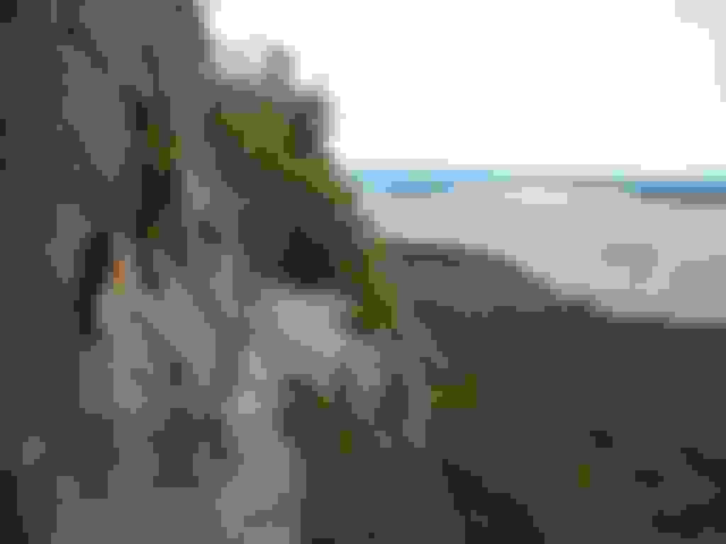
Acadia National Park,Precipice Trail, Mt Desert Island,Maine
Part of the east face of Champlain Mountain. The most challenging and well known hiking trail in Acadia National Park with an exposed and almost vertical 1,000 foot climb. It is designated as “strenuous”. Only recommended for physically fit and experienced hikers who have no fear of heights.
To those unaware,the skinny cliff side you see in this pic.....that is the trail in front of me. The drop to the right....hundreds of feet. Just to help put things into perspective. So yeah,turn sideways,lean in and if you don't wish to meet your maker,don't slip!
Native Americans have inhabited the area called Acadia for at least 12,000 years, including the coastal areas of Maine, Canada, and adjacent islands. The Wabanaki Confederacy ("People of the Dawnland") consists of five related Algonquian nations—the Maliseet, Mi'kmaq, Passamaquoddy, Abenaki and Penobscot. Some of the nations call Mount Desert Island Pemetic ("range of mountains"), which has remained at the center of the Wabanaki traditional ancestral homeland and territory of traditional stewardship responsibility to the present day. The etymology of the park's name begins with the Mi'kmaq term akadie ("piece of land") which was rendered as l'Acadie by French explorers, and translated into English as Acadia.
The Wabanaki traveled to the island in birch bark canoes to hunt, fish, gather berries, harvest clams and basket-making resources like sweetgrass, and to trade with other Wabanakis. They camped near places like Somes Sound.
Great thrilling hike! Don't attempt it if you're not an active and fit person and don't go up if you're afraid of heights.You probably won't make it.There is no place to turn around! The trail is only just barely wide enough to go one direction and that's up! Very fun! Be smart.It's no place for children.Only fools would let their kids go up this trail.It's not the safest of places for adults.It's not completely insane like angels landing at Zion National Park,it's not very far behind it either though and people have and will likely continue to die here too.This trail has many more narrower cliff sections than Zions,making this one a bit more hairy in places actually.This is why it would be pretty much impractical,if not impossible (definitely rude) to try and descend.There simply isn't enough room to pass people who are coming up.This trail will get the blood pumping.
Last edited by FORDF250HDXLT; 04-06-2020 at 08:00 PM.
Reason: Updated info
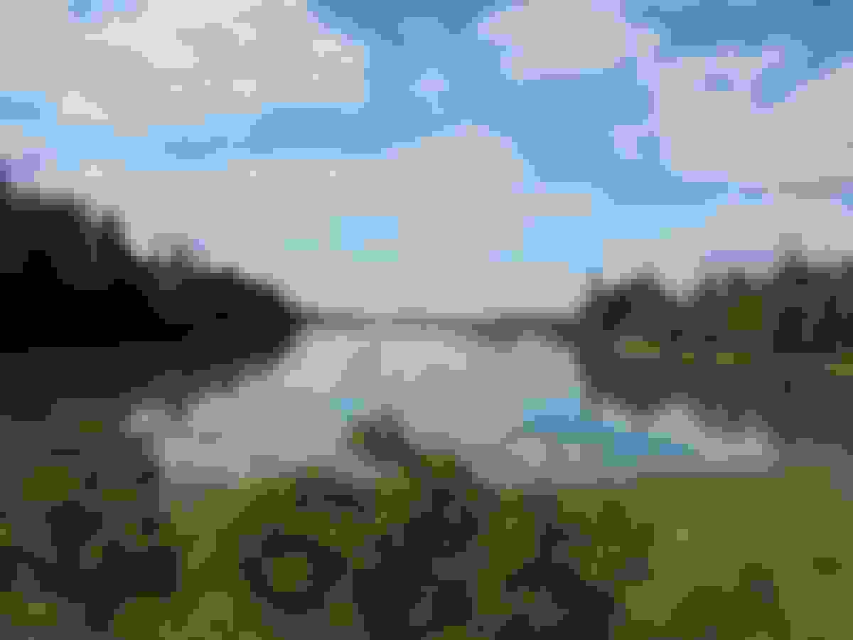
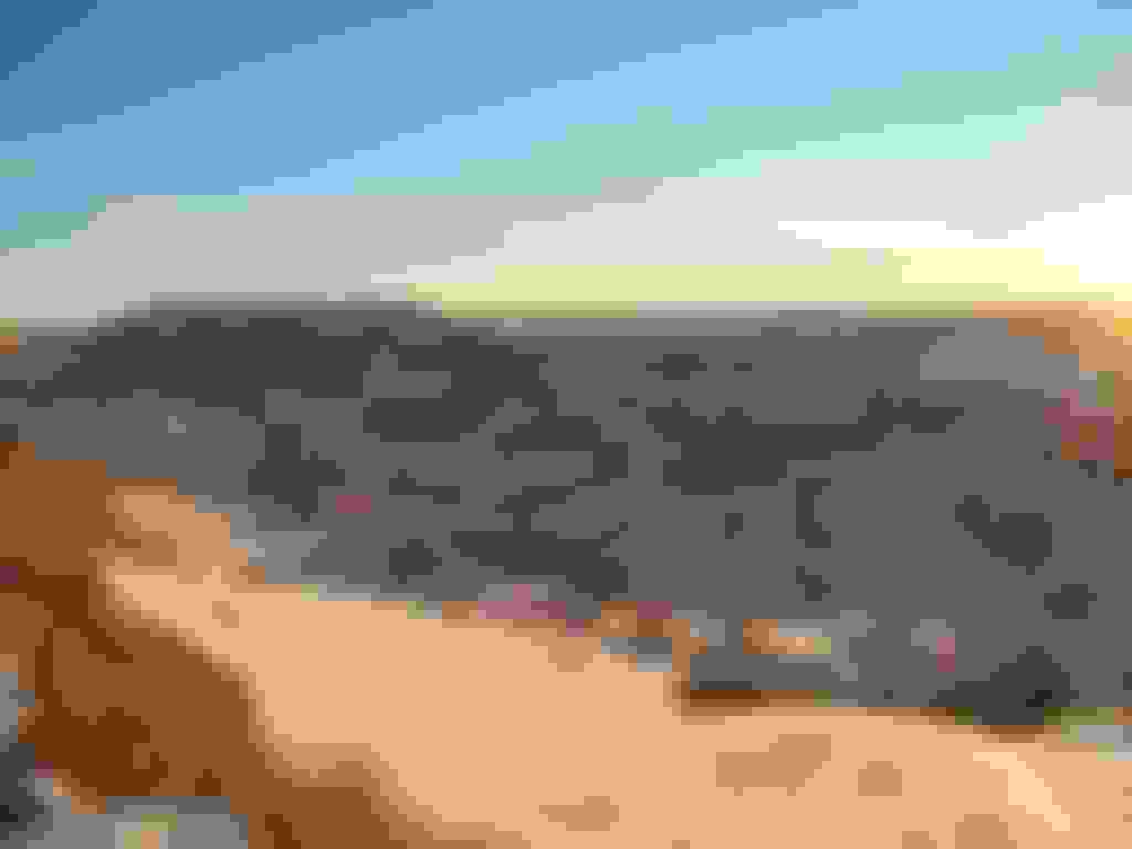
Acadia National Park,Schoodic Loop Rd,Winter Harbor,Maine
Schoodic Peninsula, the only part of Acadia National Park found on the mainland, boasts granite headlands that bear erosional scars of storm waves and flood tides. Although similar in scenic splendor to portions of Mount Desert Island, the Schoodic Coast is a more secluded area. It is about an hour drive from the Hulls Cove Visitor Center on Mount Desert Island.
Nikon D3400 - Rokinon RK24MAF-N - 15 sec exposure - F/1.4 - 3200 ISO - LLL (Low level lighting) - Four rows of ten for a total of fourty images stitched together,make up this panorama - Processed using Lightroom
Native American peoples have inhabited the land we now call Maine for 12,000 years. Today four distinct tribes�the Maliseet, Micmac, Passamaquoddy and Penobscot�are known collectively as the Wabanaki, or �People of the Dawnland.�
Mount Desert Island and Acadia National Park have remained in the center of Wabanaki traditional homelands for thousands of years. Long before Europeans arrived, the Wabanaki traveled here in seaworthy birchbark canoes. Setting up temporary camps near places like Somes Sound, they hunted, fished, gathered berries, harvested clams, and traded with other Wabanaki. Some called Mount Desert Island �Pemetic,� meaning �range of mountains.�
In the nineteenth century, Wabanaki people came to sell their handmade ash and birchbark baskets to wealthy travelers, and to harvest precious basket-making resources like sweetgrass. Summer tourists and summer residents alike were entertained by elaborate Wabanaki dance performances at venues such as Sieur de Monts and the town of Bar Harbor. Led by Wabanaki guides, canoe trips around Frenchman Bay and the Cranberry Islands were a convenient and pleasurable way for visitors to reach the outer islands.
Today, each tribe has a reservation and government headquarters located within their territories throughout Maine. Still, Wabanaki people have a unique and spiritual relationship with this land, from the first rays of dawn seen from Cadillac Mountain to the last light of dusk slipping behind Bar Island. Many Wabanaki people today come for much the same reasons as others�to hike the mountain trails and enjoy the striking scenery. Yet some still come to gather precious sweetgrass, sell handmade baskets, and to show respect for this sacred landscape, as their ancestors did for thousands of years.
The Schoodic Peninsula offers a wide array of opportunities for discovering Maine's rugged coast without all the congestion of Mount Desert Island. Whether exploring on foot, by bike, or by car, there is something for everyone.
A six-mile (10 km), one-way loop road offers views of lighthouses, seabirds, and forested islands. Vehicle turnouts that provide opportunities to stop and enjoy the scenery. Stopping on the road and parking outside of designated pull-offs are prohibited.
Arey Cove Road leads to Schoodic Point, a windswept, rocky point providing spectacular views of Mount Desert Island.
Much of Schoodic Loop Road is one-way. RVs are permitted only on the section of Schoodic Loop Road that accesses Schoodic Woods Campground. Unless otherwise posted, the speed limit is 35 mph (56 km/hr).
I don't know why it took me several years to go down and check out this section of Acadia. I often thought about it but always put it off to do something else for whatever reason. Very nice down there. A bit more of a drive over and it's not to the same level of the main part of the park but I can't imagine too many people ever said; Oh that was a waste of a drive lol. I'm glad I finally made it down. I'll be back time and time again,now that I know how nice it is.
Last edited by FORDF250HDXLT; 04-21-2020 at 01:11 PM.
Reason: Added Milky Way.Shot on June 15 through the morning of June 16,2018/ Updated info/Updated photo
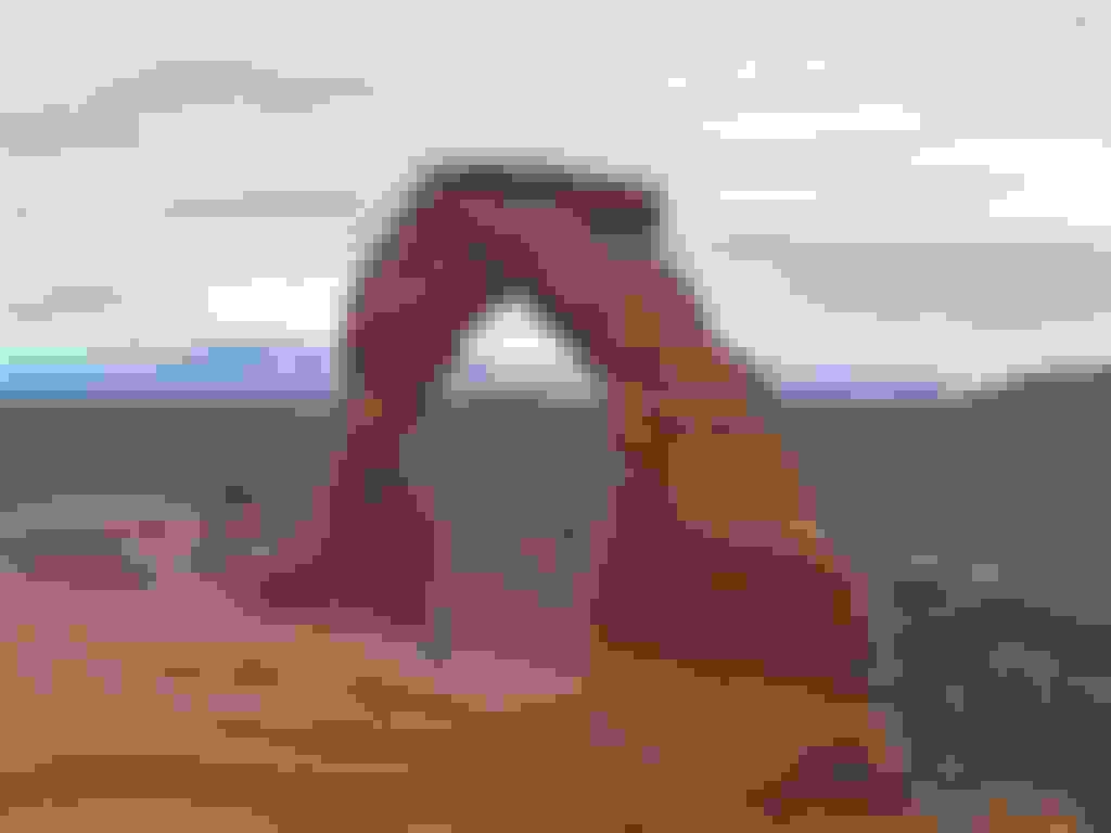
Visit Arches to discover a landscape of contrasting colors, land forms and textures unlike any other in the world. The park has over 2,000 natural stone arches, in addition to hundreds of soaring pinnacles, massive fins and giant balanced rocks. This red-rock wonderland will amaze you with its formations, refresh you with its trails, and inspire you with its sunsets.
Rocks have attracted visitors to Arches National Park for thousands of years. The earliest visitors weren't just sight-seeing, though. Hunter-gatherers migrated into the area about 10,000 years ago at the end of an Ice Age. As they explored Courthouse Wash and the Salt Valley area, they found pockets of chert and chalcedony: two forms of microcrystalline quartz perfect for making stone tools. Chipping or knapping these rocks into dart points, knives, and scrapers, they created debris piles that are still visible to the trained eye.
Then, roughly two thousand years ago, the nomadic hunters and gatherers began cultivating certain plants and settled the Four Corners region. These early agriculturalists, known as ancestral Puebloans, raised domesticated maize, beans, and squash, and lived in villages like those preserved at Mesa Verde National Park.
Few dwellings have been found in Arches, which was the northern edge of ancestral Puebloan territory, so it's possible they only visited seasonally - or that their dwellings have been lost to time. What does remain, though, are their drawings. Rock art panels are an invitation to wonder: Who made this? What were they thinking? Like earlier people, the ancestral Puebloans also left lithic scatters, often near waterholes where someone may have shaped tools while watching for game.
The Fremont were contemporaries of the ancestral Puebloans who lived just to the northwest. Distinctions between the two cultures are blurry, though certain characteristics of Fremont rock art, pottery, and other artifacts clearly demonstrate the existence of different technologies and traditions.
For a variety of reasons, people began leaving the region about 700 years ago. Descendents of the ancestral Puebloans include people living in modern-day pueblos like Acoma, Cochiti, Santa Clara, Taos, and the Hopi Mesas.
As the ancestral Puebloan people were leaving, nomadic Shoshonean peoples such as the Ute and Paiute entered the area and were here to meet the first Europeans in 1776. The petroglyph panel near Wolfe Ranch is believed to have some Ute images since it shows people on horseback, and horses were adopted by the Utes only after they were introduced by the Spanish.
For thousands of years, observing the night sky has been fundamental to human life and survival. The sky was a major symbol in the natural world of order and cyclic repetition. Studying the skies brought a sense of normalcy to people�s lives. Movement of the planets and stars helped farmers determine when to plant and harvest crops and guided ritual and religious observances. Interpretations of the celestial bodies varied widely among cultures, but often the sky was considered the abode of gods, a place humans could never touch. How do we know that sky watching was important to people of the past? Folk stories, myths, elaborate rituals and festivals, dance and costumes, and complex and symbolic architecture survive today. Today we sometimes take the vast wealth of information on the night sky for granted or are amazed by the accomplishments of ancient astronomers. Our complacency results from our own night blindness, a symptom caused by our brightly lit and building-enclosed world. Even though we no longer need to track celestial events for our daily survival, we still enjoy gazing at the sky�s majestic beauty.
Yet this simple pleasure is denied to 90 percent of the world�s population. Not only is light pollution an aesthetic problem but it also affects our sense of perspective. Most of the world�s population can no longer ponder Earth�s place in the universe because light pollution of the night sky shrinks the visible universe down from millions of light years to a few miles. One of our most ancient and universal cultural values is threatened and may become extinct.
Another super park. Utah sure has some of prime parks. This one doesn't disappoint with it's scenic views,loads of trails,park roads and arches upon arches. Rich with Native American culture as well,like so many in the National Park System. You could vacation around all these canyons in an RV for months in retirement and still never see everything.
Last edited by FORDF250HDXLT; 04-06-2020 at 08:09 PM.
Reason: Updated info
This visually stunning documentary, filmed on the remote plains of the Fort Peck Assiniboine & Sioux Indian Reservation in Northeastern Montana, features the intimate perspectives of Assiniboine tribal members, whose stories, memories and commentary convey their knowledge of cultural history and their passion and concern for their tribe and its future. A dream that became a mission inspired narrator True Archdale to return to Wolf Point after living in Los Angeles for three decades. Raised by her Assiniboine grandparents and influenced throughout her life by the teachings of her tribal community, she felt compelled to return to the reservation of her childhood to capture important personal stories of multiple generations. True believed that a record of these stories and memories could be useful in preserving the tribe’s cultural heritage. Powerful scenery and a uniquely composed soundtrack inspire viewers to take a deeper look at our collective connection to the earth. Wolf Point, Red Road Stories gives a glimpse into the complex nature and perseverance of the Assiniboine people, who after thousands of years hold close their cultural identity and continue to pass it on to future generations, while spiritually prospering in today’s world. This film was featured at the 41st American Indian Film Festival.
The rugged beauty of the Badlands draws visitors from around the world. These striking geologic deposits contain one of the world�s richest fossil beds. Ancient mammals such as the rhino, horse, and saber-toothed cat once roamed here. The park�s 244,000 acres protect an expanse of mixed-grass prairie where bison, bighorn sheep, prairie dogs, and black-footed ferrets live today.
My grandfather gazed down at me, and his words burned in my mind. He said back then, as today, the Lakota lived as one with nature. The land, sky, water, and the four-legged still are interconnected with the Lakota who are original members of the buffalo nation (Pte Oyate). Each and everyone is respected for their place in the web of life. Presiding over all is the Great Spirit. Our legacy, these truths that come from our oral tradition of storytelling are taught to the people of the world at this place. These ideas burned in their minds too, my grandfather said. - Introduction to Heritage Center Location Study for Oglala Lakota Heritage Center on South Unit of Badlands National Park (November, 1994)
The Stronghold District, also known as the South Unit, of Badlands National Park is comprised of lands on the Pine Ridge Indian Reservation owned by the Oglala Sioux Tribe and managed by the National Park Service under an agreement with the Tribe. The 133,300 acres of the Stronghold District were added to Badlands National Monument in 1976, prior to the monument becoming a park in 1978. Much of the land in the Stronghold Unit was previously used by the United States Air Force as an aerial gunnery range during World War II. Dominated by rugged badlands interspersed with mixed-grass prairie, the Stronghold District is less developed than the North Unit of the Park. There are currently few paved surfaces. Little of the National Park Service managed area is accessible by road. With the exception of Sheep Mountain Table, those hoping to explore the Stronghold District must obtain permission from individual landowners prior to crossing their land to reach the park.
True roads are a rarity in the Stronghold District. There are many �two tracks� worn into the landscape on private land as ranchers tend their cattle. These are not considered public access roads. You must obtain permission from private landowners before crossing their land to reach the National Park Service lands. These landowners can be difficult to identify or locate. Access and information on Stronghold and Cuny Tables can be obtained at the Cuny Table Cafe when open. The National Park Service cannot give you permission to cross private land. Off-road travel is prohibited in the Stronghold District.
As you travel on Pine Ridge Reservation, particularly on the South Unit of Badlands National Park, you may find signs of religious worship. These could take the shape of prayer sticks or small bundles tied to branches. It could be simply a piece of brightly colored fabric tied to a shrub. These are signs of traditional worship by Tribal members. Please respect their beliefs and practices and leave these objects.
Stronghold Table is thought to be the site of the last Ghost Dance of the 19th century. Stronghold and Sheep Mountain Tables are also favorite sites for young Lakota men to go to fast and pray, hoping to have a vision for their future.
I felt a deep connection to this park of which I cannot explain.It kind of felt like an old home from a very distant past.I enjoyed this one immensely.Since there is a free primitive campsite,I stayed for two nights.Long drive down a dirt road but it's so scenic,it's worth the drive in and out.Pitch a tent where bison free roam!
Last edited by FORDF250HDXLT; 04-06-2020 at 08:34 PM.
Reason: Updated info
Baxter Park is not part of the Maine State Park system. The park is independently funded through a combination of revenues from trusts, user fees, and the sale of forest products from the park's Scientific Forest Management Area. The park is home to the state's highest peak, Mount Katahdin. Mount Katahdin is the northern terminus of the Appalachian Trail.
The Penobscot Nation,formerly known as the Penobscot Tribe of Maine,is the federally recognized tribe of Penobscot people in the United States. They are part of the Wabanaki Confederacy, along with the Abenaki, Passamaquoddy, Maliseet, and Mi'kmaq nations, all of whom historically spoke Algonquian languages.
The word "Penobscot" originates from a mispronunciation of their name for themselves: Penawapskewi.The word means "rocky part" or "descending ledges," and originally referred to their territory on the portion of the Penobscot River between present-day Old Town and Bangor.
Native peoples are thought to have inhabited Maine and surrounding areas for at least 11,000 years.They had a hunting-gathering society, with the men hunting beaver, otters, moose, bears, caribou, fish, seafood (clams, mussels, fish), birds, and possibly marine mammals such as seals. The women gathered and processed bird eggs, berries, nuts, and roots, all of which were found throughout their native lands.
The people practiced some agriculture but not to the same extent as that of indigenous peoples in southern New England, where the climate was more temperate. Food was potentially scarce only toward the end of the winter, in February and March. For the rest of the year, the Penobscot and other Wabanaki likely had little difficulty surviving because the land and ocean waters offered much bounty, and the number of people was sustainable.The bands moved seasonally, following the patterns of game and fish.
*FALSE: "Little is known about the Penobscot before their contact with European colonizers." on the wiki page. I am here to inform you,this is very wrong and I can assure you that much is known about our Penobscot brothers before the arrival of Europeans. They are alive and well sharing their vast history and today I have the great honor of living with them in their ancestral territory and I will be sharing their stories,rich heritage,culture and history with you throughout this thread which dates back thousands of years.
Baxter State Park is a large wilderness area permanently preserved as a state park, located in Piscataquis County in north-central Maine, United States. It is in the North Maine Woods region, and borders the Katahdin Woods and Waters National Monument.
The park is home to the state's highest peak, Mount Katahdin.
Mount Katahdin consists of a cluster of mountains. The highest peak, Baxter Peak, is named after park donor and former Maine Governor Percival P. Baxter and rises up to 5,267 feet (1,605 m). The mountain is the northern terminus of the Appalachian Trail.
The park is open to overnight summer camping from May 15 to October 15 and winter camping from December 1 to March 31. Only northbound long distance Appalachian Trail hikers can stay in the park without reservations; they are limited to one night's stay at The Birches camping area, which is limited to the first twelve hikers to sign in at an information kiosk several southbound trail miles away just inside the park's southern boundary.
In addition to hiking and camping, approximately 25% of the park is open to hunting and trapping (with the exception of moose hunting). Park ponds and streams are open to either fly fishing or general law fishing as determined by the Maine Department of Inland Fisheries and Wildlife and the Baxter State Park Authority. Snowmobiling is permitted on the Tote Road, the 46-mile (74 km) dirt road connecting the park's south gate at Togue Pond and the north gate at Matagamon. The park also includes a Scientific Forest Management Area of 29,587 acres (120 km2) located in its northwest corner.
This park has been a place full of childhood memories for me,along with new ones being created through adulthood.
If you wish to come and explore Maine,I strongly recommend this park after you have visited the coast and had some lobster,for a very well rounded adventure.
Last edited by FORDF250HDXLT; 04-06-2020 at 08:56 PM.
Reason: Updated info
Beavers Bend State Resort Park, Broken Bow,Oklahoma
Towering timbers, crystal clear waters and rugged terrain make this state park an outdoor lover's paradise. The scenic beauty of Beavers Bend State Park makes it one of Oklahoma's most popular areas.
The Choctaw (Choctaw: Chahta) are a Native American people originally occupying what is now the Southeastern United States (modern-day Alabama, Florida, Mississippi and Louisiana). Their Choctaw language belongs to the Muskogean language family group. Hopewell and Mississippian cultures, who lived throughout the east of the Mississippi River valley and its tributaries. About 1,700 years ago, the Hopewell people built Nanih Waiya, a great earthwork mound located in what is central present-day Mississippi. It is still considered sacred by the Choctaw.
The Choctaw and the United States (US) agreed to nine treaties. By the last three, the US gained vast land cessions; they removed most Choctaw west of the Mississippi River to Indian Territory, sending them on a forced migration far from their homelands. The Choctaw were the first Native American tribe forced to relocate under the Indian Removal Act. The Choctaw were exiled from their land because the U.S. desired its resources, and to sell it for settlement and agricultural development by European Americans. Some US leaders believed that by reducing conflict between the peoples, they were saving the Choctaw from extinction. The Choctaw negotiated the largest area and most desirable lands in Indian Territory.
'Indian Territory' Is known as the state of (Choctaw language) Okla (red) Homa (people) today.
The Forest Heritage Center Museum is located in Beavers Bend State Park (north of Broken Bow, Oklahoma). Operated by the Forest Heritage Center Advisory Board and Oklahoma Forestry Services, the museum houses historical documents, antique forestry tools, wood art, homestead memorabilia, and a research library filled with books, periodicals, and other materials pertaining to forestry.
The scenic beauty of Beavers Bend Resort Park makes it one of Oklahoma's most popular resort areas. Beavers Bend Resort Park includes Beavers Bend State Park. Hochatown State Park, Lakeview Lodge and Cedar Creek Golf Course. The crystal clear water of the lakes and rivers, as well as the 100-ft. pine trees, make us the perfect location for your next outing. If you want privacy in a natural setting with all of the comforts of home, join us at Beavers Bend Resort Park.
Ready to hit the trails; hike amidst the towering pines, trek through the rippling creeks and experience our state�s diverse terrain and outdoor wonders? Five nature trails and approximately 12 miles of hiking trails, for every skill level are displayed on the map below.
Whether you�re an expert hiker or just enjoy recreational hiking trails, observe the trail descriptions, level of difficulty and safety information before you venture out.
It's not only really cool to check out inside this massive vacation park for campers,fisherman,water boating,swimming and extensive hiking but my favorite part; The museum is FREE! This rv/cabin state park is a real treasure.Too crowded for my taste,as I prefer to get back where no one is around but this place is a fantastic place to take the family and go have fun.Even in the winter months,when I travel,it's a pretty hot spot.I can only imagine what it's like in the summer.It's popular for a reason though.It's nice!When I say nice,I mean really nice.You'll meet people who travel from all over in here.If your a retiree with a camper,don't miss it!You'll find yourself stopping whenever going through the area every single time thereafter.I can imagine some people get down in here and never want to leave.
Last edited by FORDF250HDXLT; 04-06-2020 at 09:21 PM.
Reason: Updated info
 10-07-2017, 01:13 PM