So Cal Earthquake - dodging boulders in Anza Borrego -*PICTURES ADDED*
#1
 04-05-2010, 06:12 AM

Join Date: Oct 2005
Location: San Felipe, Baja
Posts: 567
Likes: 0
Received 0 Likes
on
0 Posts
So Cal Earthquake - dodging boulders in Anza Borrego -*PICTURES ADDED*
Yesterday my husband and I decided to go to Anza Borrego Desert State Park and drive down Fish Creek Wash and Sandstone Canyon. We'd gone a few miles into the wash, and we had stopped to watch trickles of sand running down a cliff face when we felt the truck rocking back and forth. We backed up away from the cliff and were narrowly missed by the large cooler size rocks that followed the trickles of sand. EARTHQUAKE!!
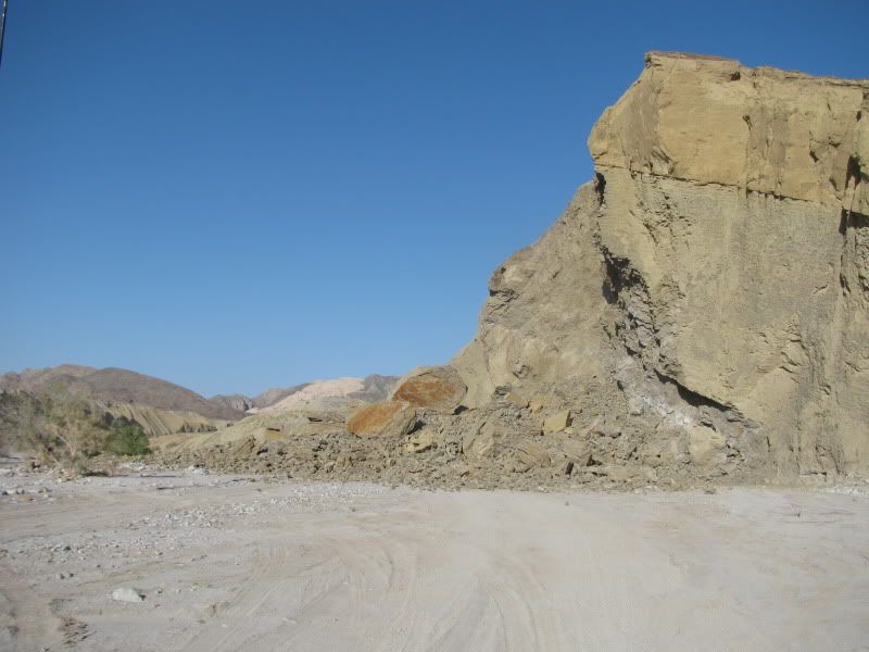
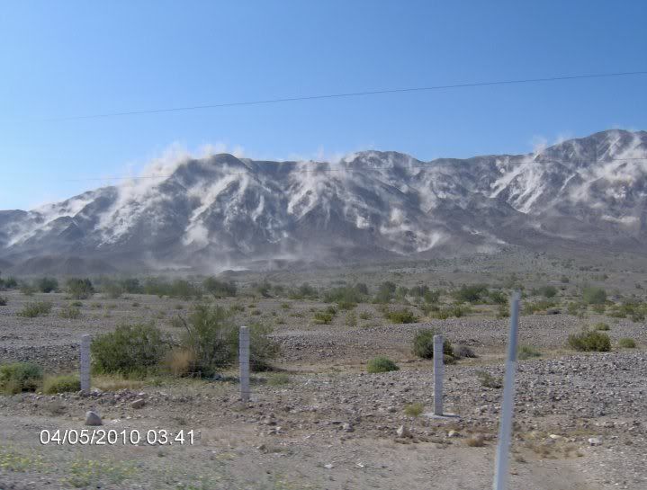
I got out of the truck and took this picture of dust rising in the distance, about a minute after the quake hit. Something big obviously had landed on the desert floor!
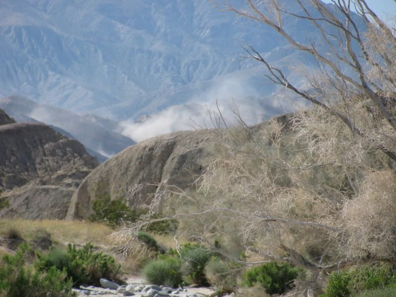
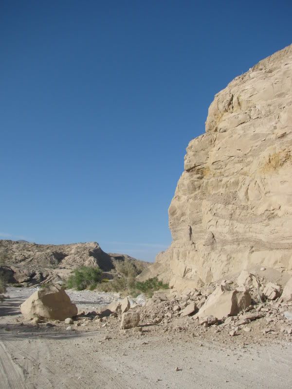
This is the first real evidence that this had been a big quake that had caused some serious damage. There were still rocks and rivers of sand coming off this cliff face.
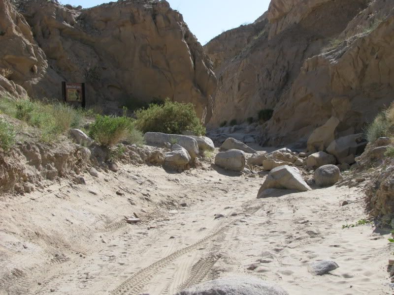
We continued down Fish Creek Wash and turned up into Broken Axle Gulch, only to find the way blocked right where the sign is posted at the first squeeze.
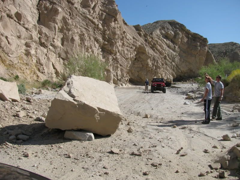
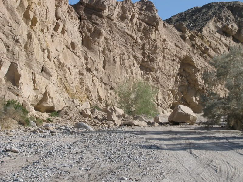
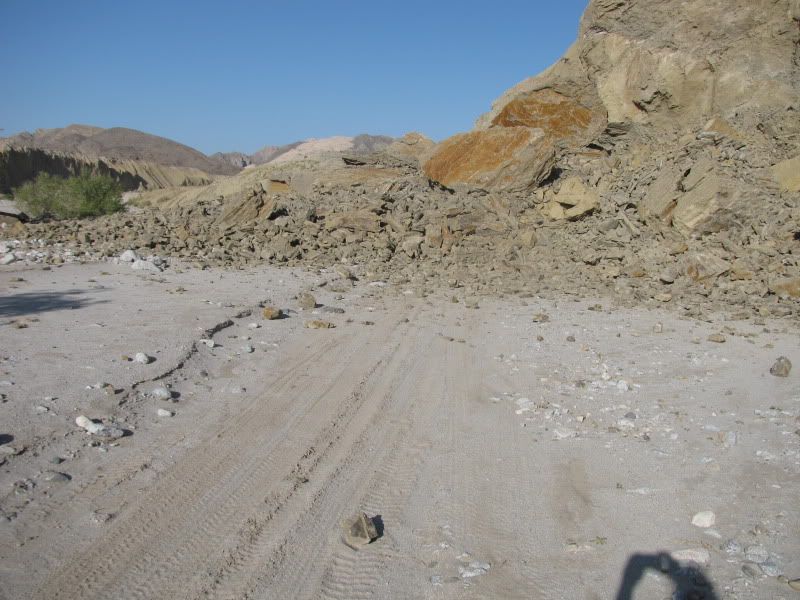
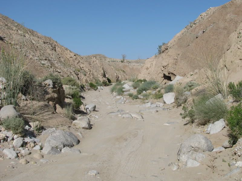
We turned around and headed back down Fish Creek and then turned in towards Sandstone Canyon. We didn't see any big rock slides, until at 1.2 miles up Sandstone Canyon we came upon this:
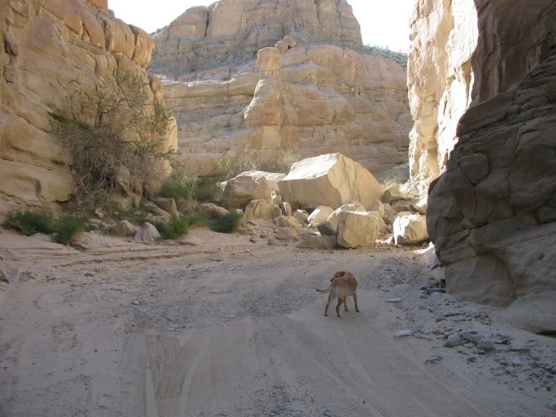
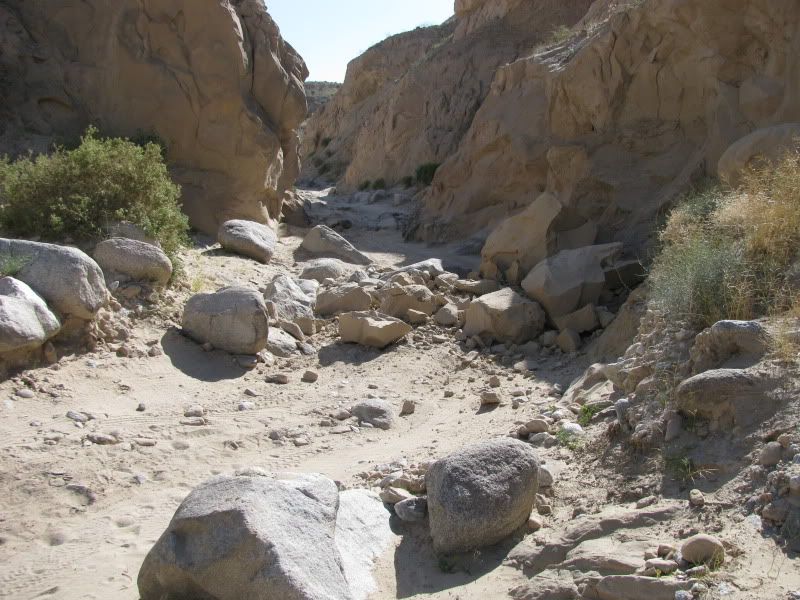
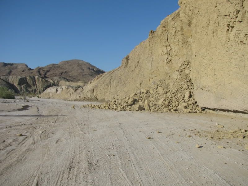
This next shot is taken just past the debris from the picture above and looking further up the canyon
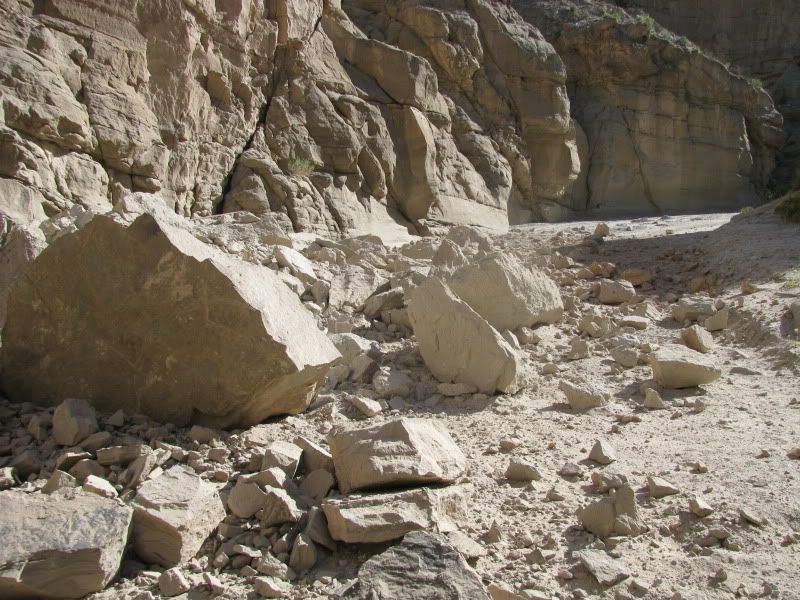
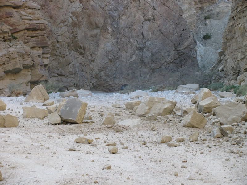
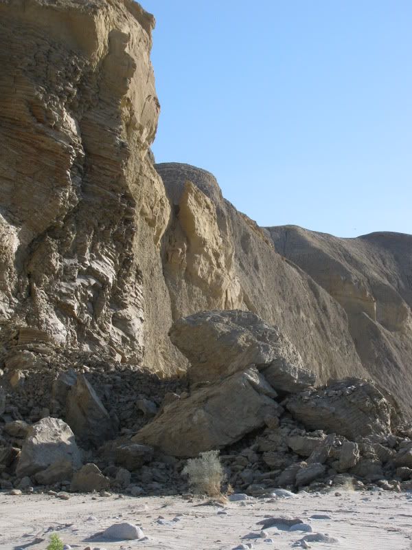
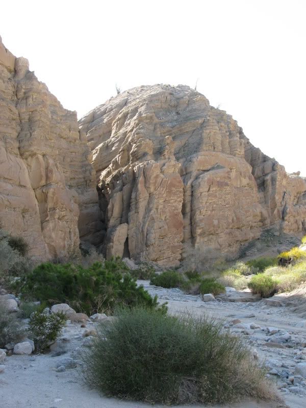
I walked up into the canyon and called to see if anyone was there and needing help. This shot was taken as I was walking back down to the truck.
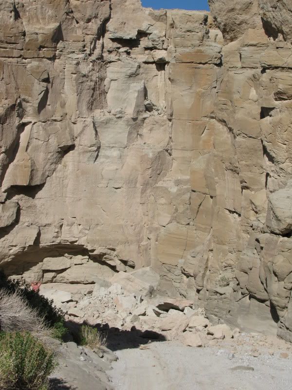
Notice the tire tracks leading up from the bottom of this next picture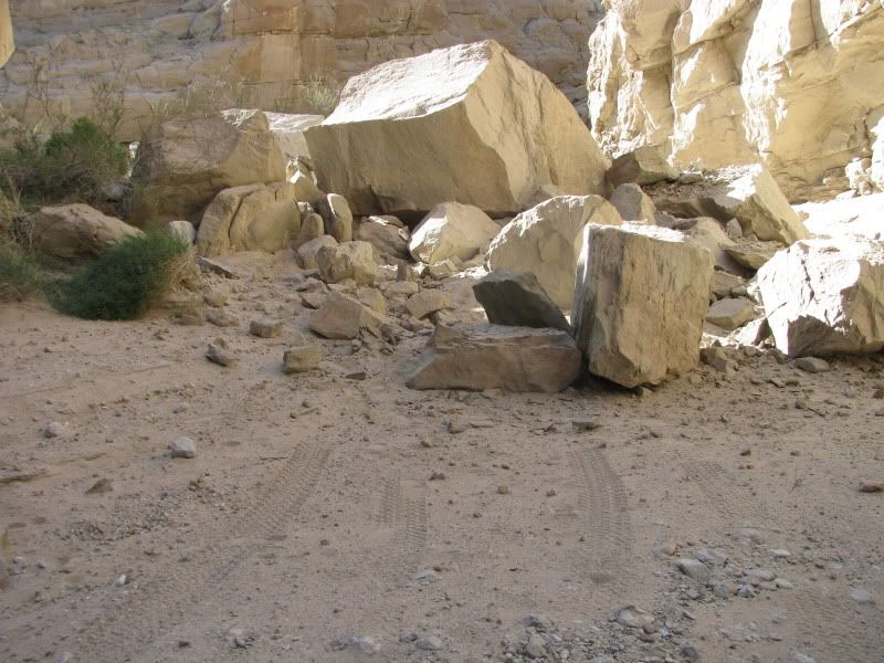
I'd say that Sandstone Canyon is blocked until someone wants to move some big rocks!
I got out of the truck and took this picture of dust rising in the distance, about a minute after the quake hit. Something big obviously had landed on the desert floor!
This is the first real evidence that this had been a big quake that had caused some serious damage. There were still rocks and rivers of sand coming off this cliff face.
We continued down Fish Creek Wash and turned up into Broken Axle Gulch, only to find the way blocked right where the sign is posted at the first squeeze.
We turned around and headed back down Fish Creek and then turned in towards Sandstone Canyon. We didn't see any big rock slides, until at 1.2 miles up Sandstone Canyon we came upon this:
This next shot is taken just past the debris from the picture above and looking further up the canyon
I walked up into the canyon and called to see if anyone was there and needing help. This shot was taken as I was walking back down to the truck.
Notice the tire tracks leading up from the bottom of this next picture
I'd say that Sandstone Canyon is blocked until someone wants to move some big rocks!

#3
04-05-2010, 08:15 AM
FTE Legend
Love the pics...looks like the 4wd clubs will be busy moving rocks for a while.
It's still shaking like crazy down there
Latest Earthquakes M3.0+ in the USA - Past 7 days
It's still shaking like crazy down there
Latest Earthquakes M3.0+ in the USA - Past 7 days
#5
04-05-2010, 09:41 AM
Join Date: Oct 2005
Location: San Felipe, Baja
Posts: 567
Likes: 0
Received 0 Likes
on
0 Posts
So Cal Earthquake - dodging boulders in Anza Borrego Pt 2
As I started to type this second part of my trip report, we were hit by another smaller earthquake. Hang on! I guess California is falling into the ocean!
As we headed out of Fish Creek Wash we came upon numerous small rock slides like this one
Looking from the other direction
And this one
This was a pretty big one; the blue truck that's behind the bush in the middle of the shot can give you a little bit of perspective
This was by far the biggest rock slide that we saw.
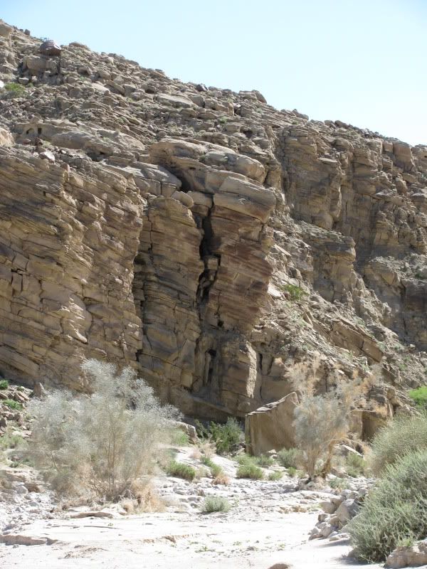
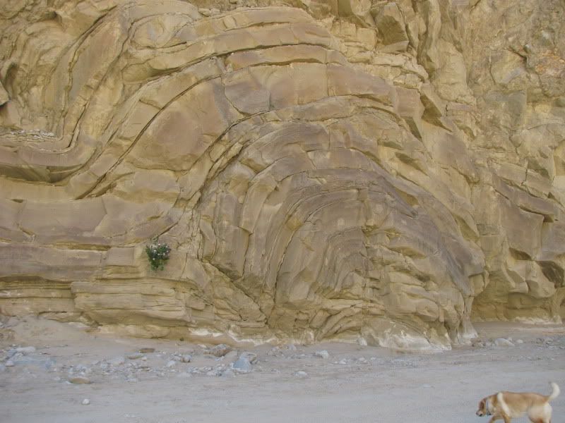
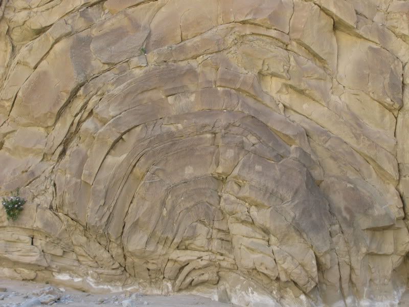
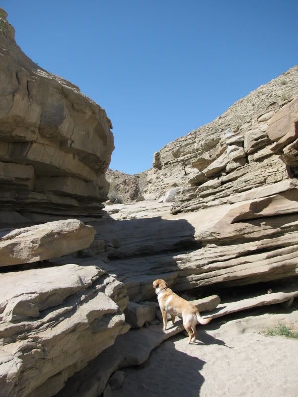
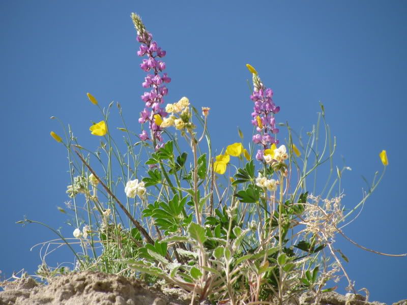
The Fish Creek Wash area is one of my favorite parts of the Anza Borrego Desert State Park. Its a shame that Sandstone Canyon is blocked only 1.2 miles from the entrance. Though it wouldnt be impossible to clear the rubble from there and also from the entrance to Broken Axle Gulch. Here are some random shots from the wash and canyon, just to show how beautiful it is there
As we headed out of Fish Creek Wash we came upon numerous small rock slides like this one
Looking from the other direction
And this one
This was a pretty big one; the blue truck that's behind the bush in the middle of the shot can give you a little bit of perspective
This was by far the biggest rock slide that we saw.
The Fish Creek Wash area is one of my favorite parts of the Anza Borrego Desert State Park. Its a shame that Sandstone Canyon is blocked only 1.2 miles from the entrance. Though it wouldnt be impossible to clear the rubble from there and also from the entrance to Broken Axle Gulch. Here are some random shots from the wash and canyon, just to show how beautiful it is there
 Let's keep it all together, please?
#7
04-05-2010, 11:17 AM
 Sounds like fun
Trending Topics
#11
04-06-2010, 06:29 PM

#12
04-07-2010, 10:43 AM

Freshman User
Join Date: Nov 2004
Location: Calgary, AB
Posts: 35
Likes: 0
Received 0 Likes
on
0 Posts
#13
04-11-2010, 05:54 PM
Join Date: Oct 2005
Location: San Felipe, Baja
Posts: 567
Likes: 0
Received 0 Likes
on
0 Posts
So California and Northern Baja continue to get rocked by aftershocks. I'm surprised at how little attention this earthquake is getting. When I've mentioned it to friends living outside of the area, alot of times I'm asked "what earthquake?". I don't know if its the problems with bringing donations into Mexico, but I haven't seen an outpouring of help as I've seen with other disasters like the recent hurricane that struck central baja. Am I just missing something?
I heard that the quake caused a change in course of the Rio Hardy, just south of Mexicali, and many homes have been flooded. I'll post pictures of this as soon as I can.
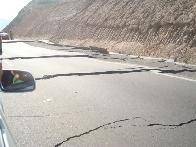
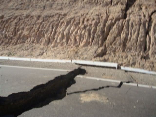
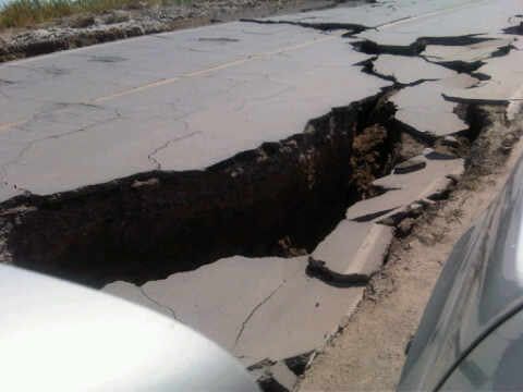
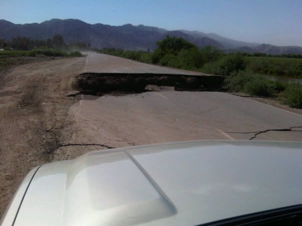
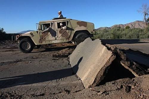
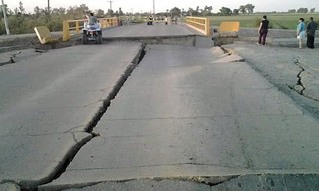
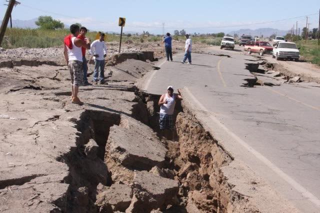
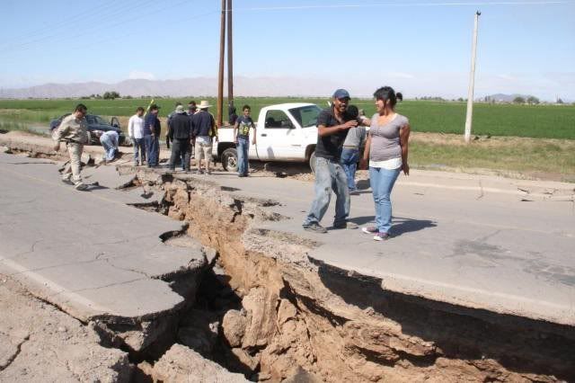
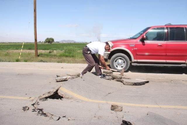
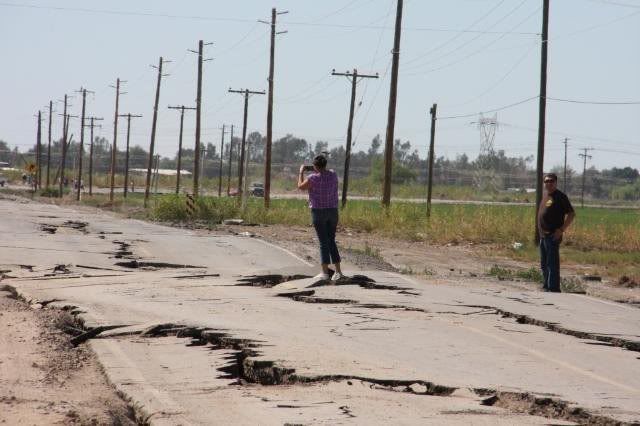
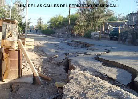
These are some pictures that I received from friends living in Baja. Some taken around Mexicali and some on the highway that connects Tecate and Mexicali:
I heard that the quake caused a change in course of the Rio Hardy, just south of Mexicali, and many homes have been flooded. I'll post pictures of this as soon as I can.
These are some pictures that I received from friends living in Baja. Some taken around Mexicali and some on the highway that connects Tecate and Mexicali:
#14
04-11-2010, 06:23 PM

Wow, that is tore up!
As far as the lack of coverage, the lack of mass casualties (vs. Haiti) or big buildings tipped over like toys (Chile) is the main reason.
That ain't the richest part of the country down there, so I suppose the main effort will be in installing "Rough Road Ahead" signs...
Thanks for the post and update.
#15
04-11-2010, 07:31 PM
Lead Driver
Join Date: Dec 2005
Location: Chino Valley, Arizona
Posts: 9,285
Received 3,697 Likes
on
1,136 Posts