Floridas BS thread..
#241
 04-18-2015, 08:04 AM

FTE Legend
Join Date: Mar 2009
Location: North Bay Ont Canada
Posts: 161,148
Received 5,160 Likes
on
1,689 Posts
#242
04-19-2015, 07:22 AM
FTE Legend
Join Date: Mar 2009
Location: North Bay Ont Canada
Posts: 161,148
Received 5,160 Likes
on
1,689 Posts


#244
04-26-2015, 04:16 PM
FTE Legend
Join Date: Mar 2009
Location: North Bay Ont Canada
Posts: 161,148
Received 5,160 Likes
on
1,689 Posts
#245
06-15-2015, 04:27 PM
Postmaster
Join Date: Jul 2013
Location: Altamonte Springs, FL
Posts: 3,504
Likes: 0
Received 0 Likes
on
0 Posts
Exploring Ontario
It was a beautiful, sunny day The temp was around 73F/23C. I decided to head for Lake Erie and explore some of the War of 1812 historic sites. Here is the route I took and I took a lot of side trips. The route as shown is 135 miles/217 kilometers. However I managed to add another 50 miles/80 kilometers to the trip with my side trips. I looked at a map before I left and programmed nothing into my GPS. I just moseyed around using dead reckoning and road signs.

I rode through a lot of farm country, villages, cross road country settlements, and an Indian Reservation. Once I got to Port Dover on Lake Erie, I found a really nice. Port Dover looks like a beach town in Florida. It even has a surf shop! There were lots of gals sunning in bikinis. I discovered that Port Dover is a biker mecca. Every Friday the 13th, the city closes the streets down to all except bikers. It turns into a mini Sturgis.
Cambridge, Ontario downtown


A general store in a cross roads village. The village had this store, a church, a truck and tractor repair shop and a welding shop

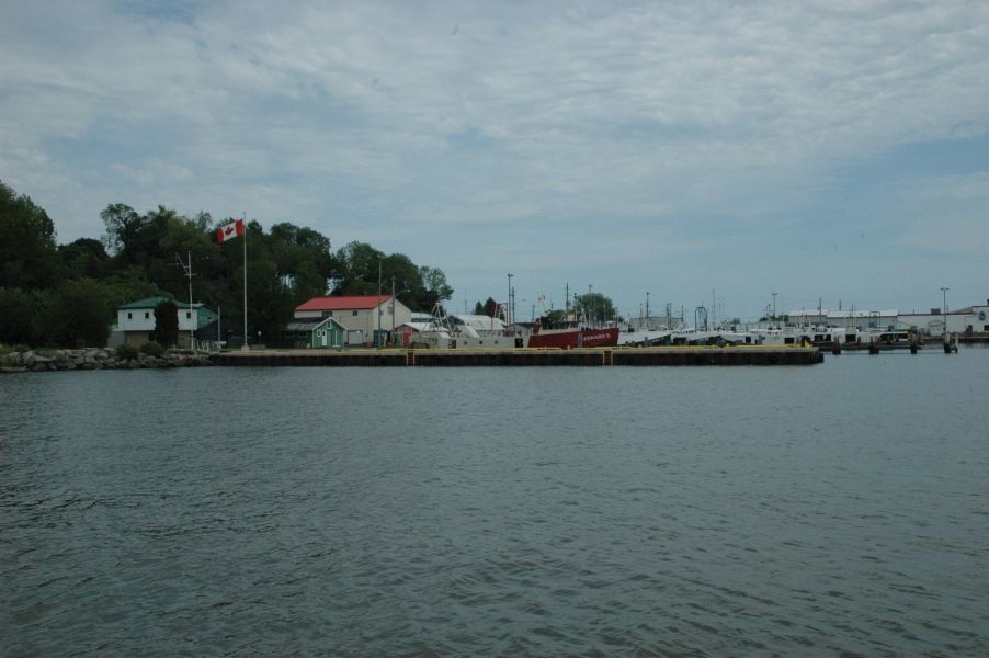
Port Dover and Lake Erie


The port where a river flows into Lake Erie. This was a vibrant port and railroad center in the 1800''s and into the mid 1900's

The beach and town of Port Dover


[img]http://www.triumphtalk.com/media/dsc_0136.7400/full]/img]

Memorial to citizens of the town who died in WWI, WWII, and the Middle East conflicts.


From the War of 1812


The gazebo is original and dates back to the founding of the town in the mid 1800's


Farmland


__________________
I rode through a lot of farm country, villages, cross road country settlements, and an Indian Reservation. Once I got to Port Dover on Lake Erie, I found a really nice. Port Dover looks like a beach town in Florida. It even has a surf shop! There were lots of gals sunning in bikinis. I discovered that Port Dover is a biker mecca. Every Friday the 13th, the city closes the streets down to all except bikers. It turns into a mini Sturgis.
Cambridge, Ontario downtown
A general store in a cross roads village. The village had this store, a church, a truck and tractor repair shop and a welding shop
Port Dover and Lake Erie
The port where a river flows into Lake Erie. This was a vibrant port and railroad center in the 1800''s and into the mid 1900's
The beach and town of Port Dover
[img]http://www.triumphtalk.com/media/dsc_0136.7400/full]/img]
Memorial to citizens of the town who died in WWI, WWII, and the Middle East conflicts.
From the War of 1812
The gazebo is original and dates back to the founding of the town in the mid 1800's
Farmland
__________________
#246
06-15-2015, 04:52 PM
Postmaster
Join Date: Jul 2013
Location: Altamonte Springs, FL
Posts: 3,504
Likes: 0
Received 0 Likes
on
0 Posts
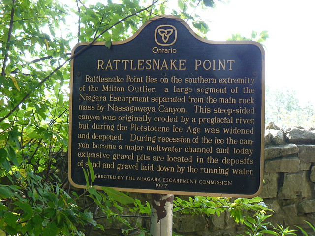
Rattlesnake Point near Milton, Ontario
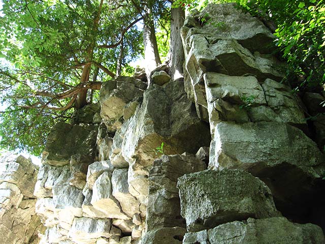
On a Saturday, Mabel and I rode up to Rattlesnake Point on the escarpment. The name comes from the serpentine shape of this portion of the escarpment, not from the Timber Rattlesnake which is not found up there. This portion of the escarpment is separated from the main Niagara Escarpment by a wide valley that was carved through the escarpment by two rivers and further gouged out by glaciers during the second ice age, about 10,000 years ago.  We hiked along the top of the ridge and admired the gorgeous scenery.

We didn't do any rock climbing; but there were a lot of people doing so.
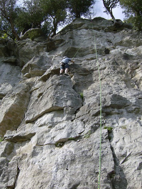
This is how we went down the face.

The trail along the ridge top.


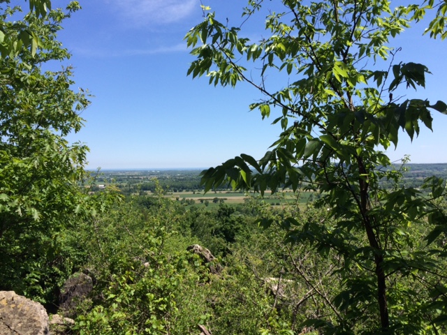
Looking southeast across the glacier created valley. The continuation of the Niagara Escarpment is the ridge in the distance. To the left of the ridge is a blue area, Lake Ontario.


[mg]ihttp://www.triumphtalk.com/media/img_0586.7386/full[/img]

__________________
We didn't do any rock climbing; but there were a lot of people doing so.
This is how we went down the face.
The trail along the ridge top.
Looking southeast across the glacier created valley. The continuation of the Niagara Escarpment is the ridge in the distance. To the left of the ridge is a blue area, Lake Ontario.
[mg]ihttp://www.triumphtalk.com/media/img_0586.7386/full[/img]
__________________
#247
06-15-2015, 08:15 PM
Awesome photo's Carl. Thank you for sharing.
I just love the small towns up north. When the warm weather hits you never know when you'll run into a street party or a whole-town car show.
I grew up in Northern Illinois and my older brother still lives in Wisconsin so we go up there every few years. Its amazing that many of the town I grew up around still look the same.
Edit: Had to add, I'd go up the same way you did.
#248
06-15-2015, 08:32 PM
Postmaster
Join Date: Jul 2013
Location: Altamonte Springs, FL
Posts: 3,504
Likes: 0
Received 0 Likes
on
0 Posts
#249
06-16-2015, 04:56 PM
Postmaster
Join Date: Jul 2013
Location: Altamonte Springs, FL
Posts: 3,504
Likes: 0
Received 0 Likes
on
0 Posts
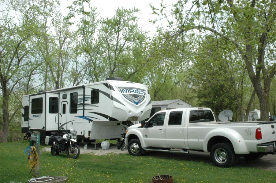
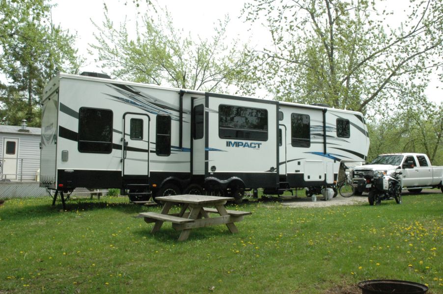
We left 85F/29C temps in Florida and arrived to find highs of 39F/4C with lows of 28F/-2C. We even had a dusting of snow!! Now the weather is the upper 70's and lower 80's with lows in the upper 50's. Much better!


We are in the escarpment country. An escarpment is a steep slope or long cliff that occurs from faulting and resulting erosion and separates two relatively level areas of differing elevations. Here the escarpments were caused by glaciers during the last ice age.
The white patches are residual snow on a ski slope.


#251
06-16-2015, 05:18 PM
FTE Legend
Join Date: Mar 2009
Location: North Bay Ont Canada
Posts: 161,148
Received 5,160 Likes
on
1,689 Posts