Anyone carry a Rand McNally atlas?
#1
 10-08-2018, 01:42 PM


Anyone carry a Rand McNally atlas?
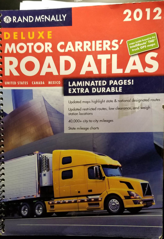
I am taking a break from the road here and got to studying my atlas - commercial carrier version from Rand McNally (not sure it makes a difference, I assume the legend terminology is the same, this is the jumbo laminated one).
Do any of you base where you stop for the night off of the "campsite", "wayside", or "rest stop" markers?
I am about 600mi in to a 1300mi trip and got to spotting the waysides and rest areas. I used to look them up as best I could online. The atlas is working a lot better for me this run. A stop may not be on the road I am on, but an adjacent one close by. Seeing them all on the big map gives me a lot of options on how far/where I can go and not over-shoot a rest stop wishing I would have stopped 30 miles later.
What I am curious about is how you determine what is where if you use an atlas. The "wayside" (as marked on the atlas that I stopped at last) was a full blown, and very nice, rest stop with semi, RV, and car parking on the border of WI and MI. It was marked as a wayside, not a rest stop. Yet other marks on the atlas as waysides are little more than a handful of parking spaces and a picnic table - no way you could get even a small bumper pull trailer through, let alone a 5th wheel or semi.
What also gets me is the state welcome centers. Some are not semi friendly, and even getting a pickup truck with a small trailer in would be borderline possible. Yet they are marked as full on "rest stops".
So looking at the marked camping icons I am assuming the same is true - the definition ofn"camping" can vary widely - car camping, RV camping, or backpack-in camping off a trail in a national forest.
#2
10-08-2018, 07:56 PM
We carry one and the wife looks at it along the way, especially when we don't have phone coverage, for interesting places around the route we are taking. She might see something of interest we wouldn't normally find on the internet and really like the added information. If we have a name of a place we can then look it up on the internet...we also use it to understand where we are at in case of bad weather listed by counties or towns close by. ...but then again we are kinda old school too as when we got married we crossed the country as two youngsters with a road atlas...
#3
10-09-2018, 07:43 AM
Lead Driver
I am taking a break from the road here and got to studying my atlas - commercial carrier version from Rand McNally (not sure it makes a difference, I assume the legend terminology is the same, this is the jumbo laminated one).
Do any of you base where you stop for the night off of the "campsite", "wayside", or "rest stop" markers?
I am about 600mi in to a 1300mi trip and got to spotting the waysides and rest areas. I used to look them up as best I could online. The atlas is working a lot better for me this run. A stop may not be on the road I am on, but an adjacent one close by. Seeing them all on the big map gives me a lot of options on how far/where I can go and not over-shoot a rest stop wishing I would have stopped 30 miles later.
What I am curious about is how you determine what is where if you use an atlas. The "wayside" (as marked on the atlas that I stopped at last) was a full blown, and very nice, rest stop with semi, RV, and car parking on the border of WI and MI. It was marked as a wayside, not a rest stop. Yet other marks on the atlas as waysides are little more than a handful of parking spaces and a picnic table - no way you could get even a small bumper pull trailer through, let alone a 5th wheel or semi.
What also gets me is the state welcome centers. Some are not semi friendly, and even getting a pickup truck with a small trailer in would be borderline possible. Yet they are marked as full on "rest stops".
So looking at the marked camping icons I am assuming the same is true - the definition ofn"camping" can vary widely - car camping, RV camping, or backpack-in camping off a trail in a national forest.
Do any of you base where you stop for the night off of the "campsite", "wayside", or "rest stop" markers?
I am about 600mi in to a 1300mi trip and got to spotting the waysides and rest areas. I used to look them up as best I could online. The atlas is working a lot better for me this run. A stop may not be on the road I am on, but an adjacent one close by. Seeing them all on the big map gives me a lot of options on how far/where I can go and not over-shoot a rest stop wishing I would have stopped 30 miles later.
What I am curious about is how you determine what is where if you use an atlas. The "wayside" (as marked on the atlas that I stopped at last) was a full blown, and very nice, rest stop with semi, RV, and car parking on the border of WI and MI. It was marked as a wayside, not a rest stop. Yet other marks on the atlas as waysides are little more than a handful of parking spaces and a picnic table - no way you could get even a small bumper pull trailer through, let alone a 5th wheel or semi.
What also gets me is the state welcome centers. Some are not semi friendly, and even getting a pickup truck with a small trailer in would be borderline possible. Yet they are marked as full on "rest stops".
So looking at the marked camping icons I am assuming the same is true - the definition ofn"camping" can vary widely - car camping, RV camping, or backpack-in camping off a trail in a national forest.
Before I retired, I had never seen so many lost truck drivers as when they all had GPS navigation!!! Finding someone that can follow directions and a paper map is just about impossible any more!! LOL
#4
10-09-2018, 08:27 AM
Lead Driver
#5
10-09-2018, 10:23 AM

Have you looked at something like this:
https://www.rvtripwizard.com/
Electronic, and RV focused. I use Gaia GPS as a downloaded map that doesn't require wi-fi to run. It's designed for hiking/off-road, but works fine if you either download ro make .gpx files for highways.
https://www.rvtripwizard.com/
Electronic, and RV focused. I use Gaia GPS as a downloaded map that doesn't require wi-fi to run. It's designed for hiking/off-road, but works fine if you either download ro make .gpx files for highways.
#6
10-09-2018, 11:05 AM
I will be over the road in a semi shortly, so the commercial version is best suited to that, but I dont think that affects the legend and definitions of the icons. Aside from the base map/icons I think the only details that vary are, for example on the commercial version, the clearances listed as well as the marked "truck routes" on the map (orange highlighted routes) as well as the regulations section on weights ect.
Im still curious how those that use the atlas for getting to a place to stop and rest figure it out.
I agree having paper maps is important. I used to go out on our lake with others navigating - guides and my grandfather. A few years ago before my grandfather passed away I realized I didnt "know the lake" like he did and no longer had the ability to learn it from him. I found a paper chart in the cabin of our portion of the lake, got a compass, and learned that part of the lake - just about every where that the chart showed. The next year I bought the full chart set for the lake. I want to say it is about 12 or 14 charts? All laminated. I also got a chart plotter - nice 8" screen Garmin with Bluechart G2 Vusion cartography. The autoguidance nav and route tracking is nice when going out a couple hundred miles on the lake, but I will never leave the dock without charts and a compass if I am not absolutely sure of where I am. They dont quit
Same theory holds true for the atlas. You cant run a vehicle in to a rock and sink it like you can a boat though. You can still get lost in a hurry on land or water.
#7
10-09-2018, 10:17 PM

Even though gps and phone navigation have come a long way I still like to navigate by my charts. In my rural area even today gps still doesn�t have it all right.
as far as rest stops and such I�ve learned to slow down but not comit until I can hopefully see the accommodations. I have backed up the edge of off ramps due to not being able to fit in or through a place or two.
You have to keep up to date charts some of mine are so old many roads have been added since they were printed. One even has �There be Dragons here� on the eastern margin guess that�s I never camp in New Jersey!!
shawn
Trending Topics
#8
10-09-2018, 10:57 PM
If you look up Virginia, MN route 53 has been re-routed. It is still under construction, actually. I hit the re-route the first time back in June of this year. Rt. 53 has been, and will be, under construction for many years.
My atlas is printed for 2019, not sure of the actual print date but the series is for the 2019 year. It already has the re-route on the map. My nav in the truck... it is at least 7 years out of date, and even when it was new was missing some already-in-existence re-routed state routes. Close enough for most of what I do with it, though.
As for the marine charts - for depth and the lay of the lake the paper charts I have are good. The Bluechart cartography in my plotter - same deal. Though, the plotter let me down in June. I was about 80 miles out and went to a "marina" marked in a harbor looking for gas. It was a secluded boat launch with a couple docks. I had to ask around and found I had to go about 5 miles down the bay, out of the way, to get to a "marina" with gas. Oh well. I had enough gas to get home, but if I got more I could keep on exploring. And I did.
#9
10-11-2018, 05:16 AM

#10
10-11-2018, 06:18 AM
I keep an older Rand McNally in the truck but mostly use GPS for navigation. I did have a GPS just quit on me during a trip - working fine one minute, nothing the next. At least we were able to hit a rest stop within 20 minutes or so and picked up a small state printed map - not a whole lot of detail, but at least it was free. Once we got to wherever it was we'd intended to get to, I ordered the atlas, put it in the truck as soon as it arrived and that's where it stays - just in case we ever need it.
#11
10-11-2018, 08:04 AM
Lead Driver
kgburns post reminded.
Warning..thread drift, how many actually hook their gps up to your computer and back up "way points" or "favorites" however they're called. So if the gps gos down for the count or you just buy a new unit you can transfer them over. I know personally with hundreds in my unit it would suck to lose them.
Warning..thread drift, how many actually hook their gps up to your computer and back up "way points" or "favorites" however they're called. So if the gps gos down for the count or you just buy a new unit you can transfer them over. I know personally with hundreds in my unit it would suck to lose them.
#12
10-11-2018, 08:14 AM
kgburns post reminded.
Warning..thread drift, how many actually hook their gps up to your computer and back up "way points" or "favorites" however they're called. So if the gps gos down for the count or you just buy a new unit you can transfer them over. I know personally with hundreds in my unit it would suck to lose them.
Warning..thread drift, how many actually hook their gps up to your computer and back up "way points" or "favorites" however they're called. So if the gps gos down for the count or you just buy a new unit you can transfer them over. I know personally with hundreds in my unit it would suck to lose them.
Good point. I dont track my road travels any more than once in a blue moon I record a track with an app called "Gaia GPS" - same I use backpacking, biking, and on the boats at times.
For the things I do track - it is stored on an SD card. I have folders for different things on an external hard drive for the hard backups.
A couple years ago I had a program that would convert Garmin waypoints and tracks to .kml for google earth. Gaia GPS exports to .kml also. It was neat to load all that data in to Google Earth to view.
If you have tracks recorded of your travels try loading them on a big map like Google Earth. It is cool seeing it all displayed.
#13
10-11-2018, 08:46 AM
Lead Driver
I did the same thing where they're on the Google earth for my desk top but not shared on the internet (if there is such a thing  ). I don't save road trips, just way points. After working in every continental state and traveling camping/ boondocking in 40+ states there are few way points I wouldn't want to lose.
). I don't save road trips, just way points. After working in every continental state and traveling camping/ boondocking in 40+ states there are few way points I wouldn't want to lose.
#14
10-11-2018, 10:17 AM
GPS Visualizer: Convert GPS files to plain text or GPX
The site also lets you "draw" your own routes and create waypoints on a Google-map type interface.
#15
10-12-2018, 05:19 PM
I never leave home without it. We use Google Maps and the internet on our phones mostly, the map is always there as a backup. For fuel stops we use the Loves and Pilot apps. It's nice having a physical map to look at to get an idea where we are and how much farther we need to travel. Mine is a bit outdated and hasn't failed me yet.