When you click on links to various merchants on this site and make a purchase, this can result in this site earning a commission. Affiliate programs and affiliations include, but are not limited to, the eBay Partner Network.
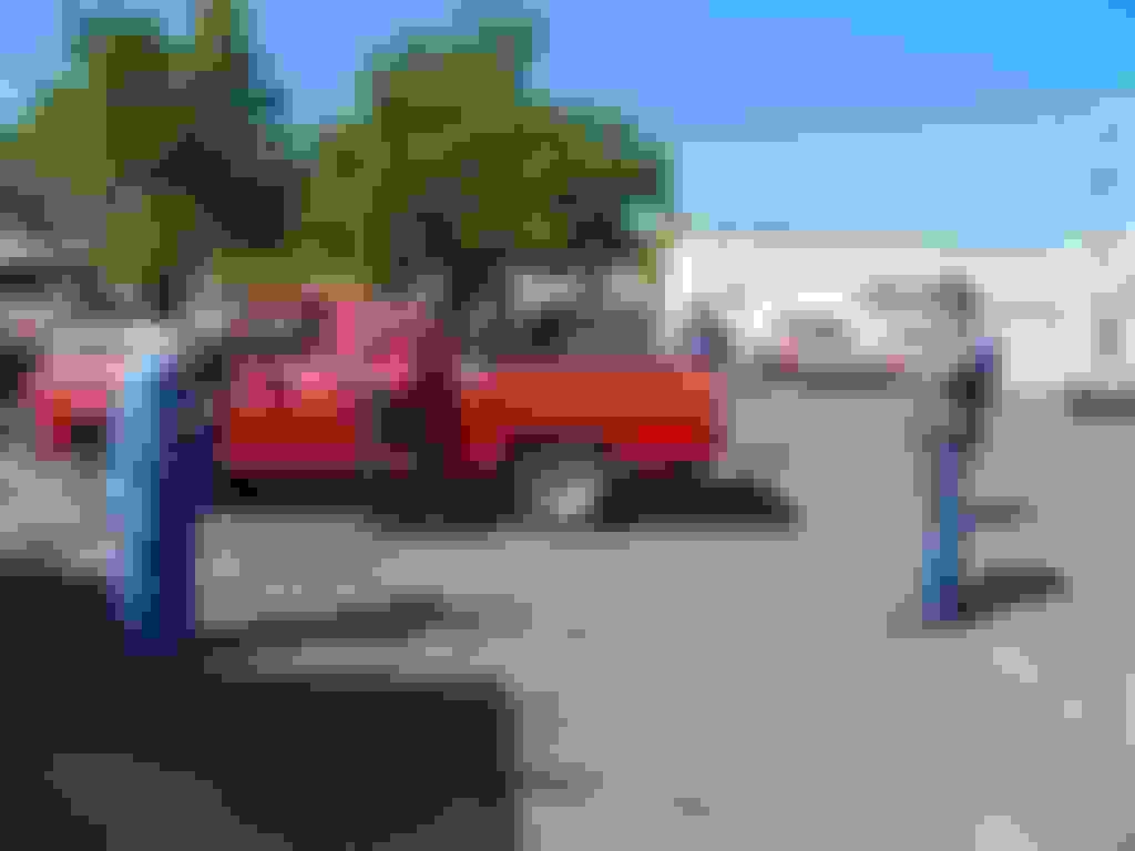
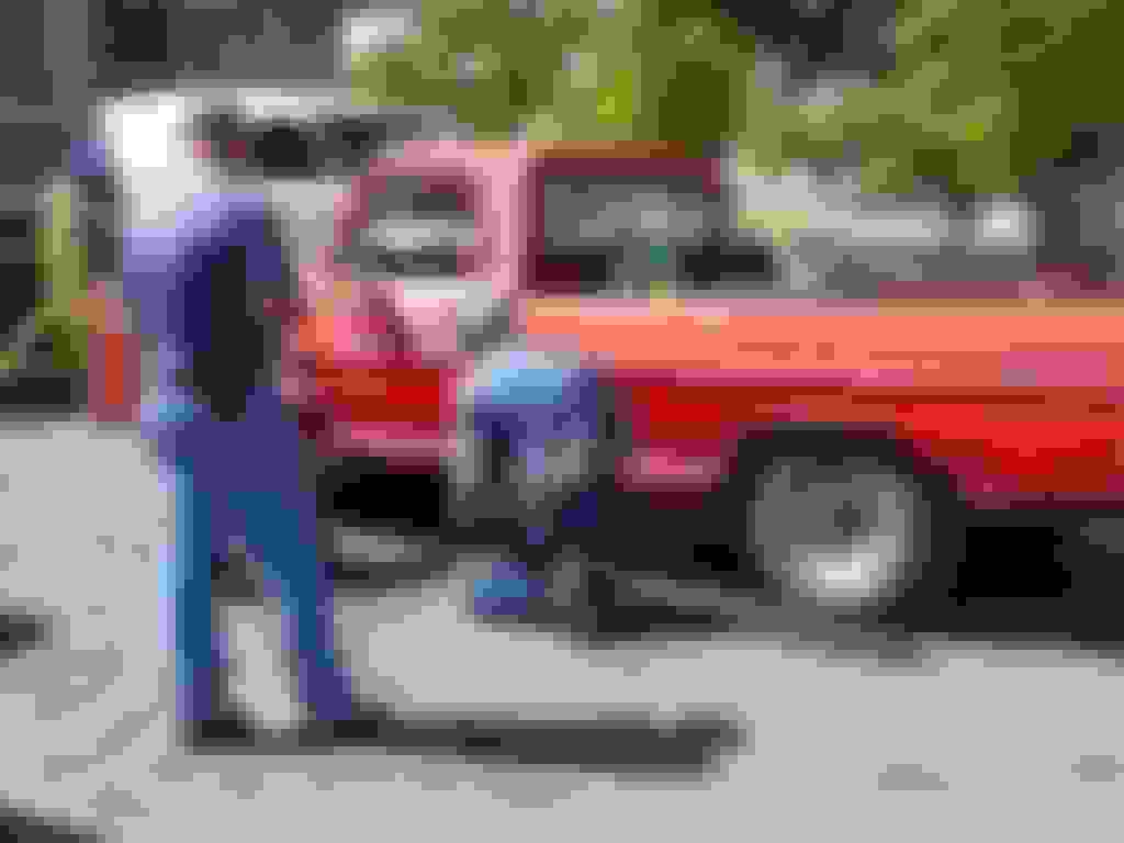
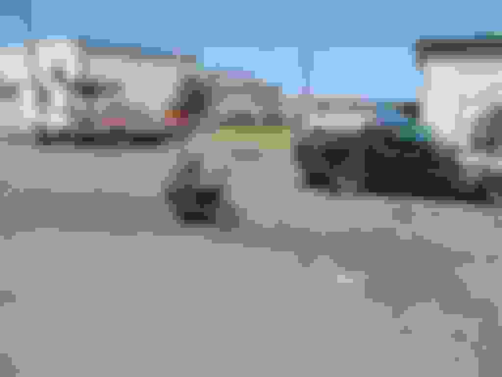
As was mentioned earlier, Don's granddaughter, Nakayla, arrived at the GTG needing universals and to eliminate a leaky fuel line. She came to the right place. While there were plenty of coaches and advisors, there weren't many "helpers". Most of those tried to make a hasty exit every time a camera was pointed in that direction. Every once in a while, someone would bend over or get on their knees and look under the truck just to see if she was still working, taking a knap or was trapped under a drive line.
As can be seen here, Don was doing his part keeping Tippy from "helping" out under the truck. The dog was more than willing to help, but every time either of the good will ambassadors went under the truck, there was a lot of squealing, giggling and the work seemed to come to a stop.
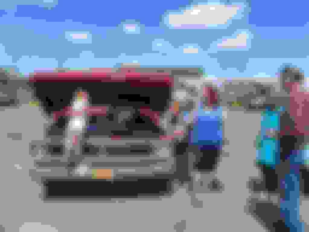
Craig has assumed the "Supervisory" position!
Mike taking on a "foreman" roll and checking to make sure Nakayla isn't taking a nap.
Don and Craig had to take a closer look with Rob on "over watched", as Nakayla was giving instructions on how to keep track of a 1/2 inch socket right after a drive line and a lot of interesting "descriptive" metaphors came rolling out from under the truck.
Wow, she can get her hands dirty, I see why everyone backed off...........it might rub off!
There was a lot of debate about what effect and how much easier the job is made by utilizing the proper flip flops and the proper paint job on the toe nails. Some suggestions were offered as to the benefits of matching paint.
We learned that "memory" foam seat pads would be a good "mod" for the fender wells in any Ford Pickup. We also learned that if something is leaking, wasn't put together just right or if Nakayla didn't have the correct wrench, "It's all Harley's fault!" - "Harley did it!" - "Yep, Harley did that too!"
Then the GTG also had it's really serious and critical moments:
Harley giving motorcycle riding demo's and instruction............Look out Team Oregon you have competition!
The Good Will ambassadors waiting for the next visit and "treats". By the way, both are now on a diet.........they gained 20 pounds in 2 days!
But as all good things must, it had to come to an end and it was time to go home. (Really? Who is the idiot that came up with that?)
Wow! It looks like the winds slowed down a bunch from when I drove home earlier in the day. Isn't it fun driving a pickup and camper into a headwind?
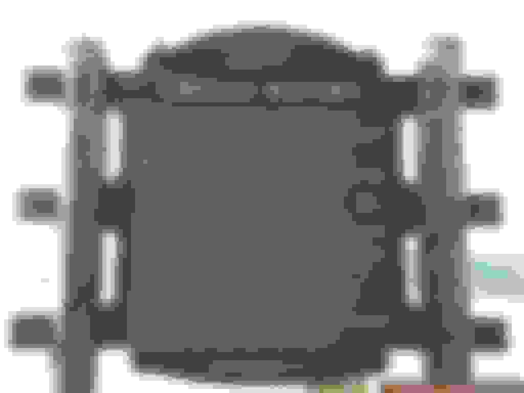
Where is the "real" survey mark? Notice the arrow on the picture. This is a reference marker for the true point... the arrow generally points in the direction of the marker. Still a cool picture of a fairly old survey marker.
Wow! It looks like the winds slowed down a bunch from when I drove home earlier in the day. Isn't it fun driving a pickup and camper into a headwind?
Where is the "real" survey mark? Notice the arrow on the picture. This is a reference marker for the true point... the arrow generally points in the direction of the marker. Still a cool picture of a fairly old survey marker.
This is a second marker that was about 10' from the first marker:
Both seemed to be pointing right at the River about 10' North of the markers, the wind was chilly and I didn't have any scuba gear with me.
The survey stake may have been out on the island.
The wind was just wonderful thank you. I was late enough and the last pics were far enough west that I had exited the "vortex". From Biggs to just a few mile east of Troutdale was just wonderful. I watched the fuel gauge spinning backwards. It took more diesel to get from Biggs to Troutdale than it took for the entire trip up!
How come one says "tunnel 1", and one says "tunnel 2"? Tiny?
When the USC&GS set these triangulation stations they usually set several 4-5 reference marks. Each one has an azimuth and distance to the true station mark.
So... "tunnel 1" is the first reference mark for "tunnel" and "tunnel 2" is the second reference mark.
We used to use these marks all the time. But now with GPS they are quickly going by the wayside. Kind of like older vehicles... send them to the crusher if they don't have satellite radio, dvd, computer wiz bang.
BTW... I'm going to have to turn you in to the "Survey Police". I noticed that you have a survey mark on your book shelf in the shop office.
How come one says "tunnel 1", and one says "tunnel 2"? Tiny?
By knowing the name of the station you can get all of the data that has been recorded by the NGS - National Geodetic Survey... previously known as the USC&GS, etc.
Here is an excerpt for the directions and description for the station that Jim photographed.
"DESCRIBED BY COAST AND GEODETIC SURVEY 1956 (JBW)
THE STATION IS LOCATED AT THE NORTH EDGE OF THE PARKING AREA AT TUNNEL POINT WHICH IS ABOUT 5.0 MILES EAST OF TROUTDALE, AND 1.0 MILE NORTHEAST OF CORBETT. IT IS 33.0 FEET SOUTH OF THE SOUTH EDGE OF THE BANK OF THE COLUMBIA RIVER, 31.5 FEET EAST OF THE EAST END OF A LARGE WOODEN HISTORICAL MARKER, 12 FEET EAST OF A WHITE WITNESS POST, AND 7 FEET NORTH OF THE GUARD RAIL OF THE PARKING AREA.
TO REACH THE STATION FROM THE TROUTDALE INTERCHANGE OVERPASS GO EAST ON U.S. HIGHWAY 30 FOR 5.6 MILES TO THE TUNNEL POINT PARKING AREA ENTRANCE. TURN LEFT AND GO ABOUT 100 YARDS TO THE NORTH END AND THE STATION.
THE STATION MARK, A STANDARD DISK STAMPED TUNNEL 1956, IS
SECURED TO THE TOP OF A 2-INCH CAST IRON SOIL PIPE THAT PROJECTS ABOUT 12 INCHES ABOVE THE GROUND.
REFERENCE MARK 1, A STANDARD DISK STAMPED TUNNEL NO 1 1956, IS SECURED TO THE TOP OF A 2-INCH CAST IRON SOIL PIPE THAT PROJECTS ABOUT 6 INCHES ABOVE THE GROUND.
REFERENCE MARK 2, A STANDARD DISK STAMPED TUNNEL NO 2 1956,
RD0026'IS SECURED TO THE TOP OF A 2-INCH CAST IRON SOIL PIPE THAT PROJECTS ABOUT 6 INCHES ABOVE THE GROUND."
The descriptions are neat and very interesting. Do you have to have a special book or is there a web site you can go to for these descriptions?
A lot has changed since 1956. I didn't see any tunnels anywhere around. These were about 6'/7' north of the guard rail and a number of feet east, (maybe 31' but didn't pay enough attention to that) of the historical marker relating Vancouver Point and Admiral Hood, for which Mt. Hood was named. However, there is no way either of them were more than 10' from the edge of a 10' cliff and the water, unless they are talking about the station they are pointing to. If that is the case then the station is now under asphalt in the historical viewpoint parking area and pull out.
In the above photo's, (the one looking upstream with my shadow in it), I was standing right on top of the Tunnel 2 marker when I took that shot. You can see the water is no longer in the location described.
This was on I84 (Hwy 30?), east bound only "viewpoint" pull out.
I get hooked on this history stuff quicker than starving trout woofing down power bait.
You don't need anything special to find this info. Just go to the NGS web page. I'll post a link when I get to the office tomorrow.
US 30 was the route through the Gorge. Now I-84 is what we know it by... remember not too long ago it was I-80N. The US 30 designation still exists. Sometimes they are separated and sometimes the are on top of each other. Kind of like Highway 99 they join up at Junction City then split up to become 99E or 99W.
On an unrelated note... I drove by your place again but didn't have time to stop. We are dealing with our own elder family member drama. I made the great loop through Sherwood and points west. Through Hebo, then up 101 to our place at the beach. Moved my BIL's camper (he's out of town for work) then came home through Tillamook, Banks, Beaverton then home.
Great stuff guy's. Thanks for posting all the pics and BS. When ya all have
one of these GTG I always wish for a bit that I wasn't on an Island that I can't afford to get
off of very often. Than I head up to Memorial Beach for a week long
camping trip, Pig out on fresh crab, Halibut, Venison and the wonderful
scenery we have here just to name some. I realize then that I will be on
this rock till my Lord brings me home. Then I think and wish I was rich
and could afford to ship a bunch of ya all up here to see and enjoy all
there is to offer.
I came up here in March of 77 and other than a short trip outside about
every ten years I have never left. There is not much anywhere on this
earth that the same or similar can't be found here or at least in this State.
Except for people. And I don't really see that as a bad thing. I am leaving
at 2:00PM for Anchorage and will get there around 10:30 PM.
Gives an Idea just how big a place this is. Sorry Texas but I think there are
country's that are smaller than here.
If my eldest (13) son will let me I will bring my Lap Top and check in
on ya all. I should be home Friday evening.
As promised here is a link to the NGS (National Geodetic Survey) web page. NGS is a division of NOAA. Formerly the USC&GS (United States Coast and Geodetic Survey).
Locating a survey marker (national level stuff) is a bit tricky. If you know the exact name and spelling of the mark... which Jim was so kind as to provide, that helps. If you know the USGS Quadrangle (quad map) where the mark is located that also helps.
There are literally millions of marks of all sorts everywhere. They are easiest to find on a mountain top with good visibility... like a fire lookout. There are benchmarks and other monuments too. The USC&GS ran precision level loops along a lot of old state highways and railroad lines. I saw several location markers along Oregon 206 on my way home from Don's on Sunday morning. These were most likely benchmarks from one of those level loops.
Here's a link to the quad map for Don's little slice of paradise.
Don's place is located near the top of the map at the center.
Just scroll down until you get to Schott Canyon. The little ticks marked "BM XXXX" are bench marks. There are three or four on the road from the highway to Don's place. The data is available from the NGS.
Being the "survey nerd" that I am. I researched the original survey of the area where Don lives. It was surveyed by the GLO (Government Land Office) in 1880+/-. The surveyor set a stone or a 4" square wood post every half mile running from the south to the north. There was also a mound of stones around these markers. It was a very interesting read. The bottoms of the canyons were reported to have good soil and the plateau where Don lives also had good grass... for grazing I presume.
Being on the "wet side"... the valley was surveyed first. Being better soil for cultivation and such. Our area was surveyed beginning in 1852. It took 30 years for them to reach Gilliam County.
Once in a while we (survey nerd types) find an original wooden stake. It's an amazing thing to find a piece of wood that has been miraculously preserved for over 150 years. It's somewhat common to find an original reference mark for these monuments. The stone mounds that I mentioned are reference marks. Last year I was working on a survey project for one of the properties that the County owns. I found an original bearing tree. Back in 1854 it was a 36" Douglas Fir. It's now a 77" Douglas Fir. An amazing find and gigantic tree. Just about as much fun as some of the old stuff Don has been restoring like the lathe and milling machine.
 06-03-2014, 09:08 AM